Cof Cymru: National Historic Assets of Wales · Wales
Milepost on A486
Llanarth, Ceredigion, Wales
A Grade II listed building in Pentre'r Bryn, Llanarth, Ceredigion, designated on 16 February 1996.
The record
- Designation
- Listed building, Grade II
- Broad class
- Transport
- Date of designation
- 16 February 1996
- Locality
- Pentre'r Bryn
- Community
- Llanarth
- Unitary authority
- Ceredigion
- Country
- Wales
- Coordinates
- 52.16984, -4.34184
- Cadw reference
- 17736
Slide toward Today to fade the historical sheet and see the modern map underneath.
David Rumsey Map Collection, Stanford LibrariesDavid Rumsey Map Collection, Stanford LibrariesDavid Rumsey Map Collection, Stanford LibrariesDavid Rumsey Map Collection, Stanford LibrariesDavid Rumsey Map Collection, Stanford Libraries
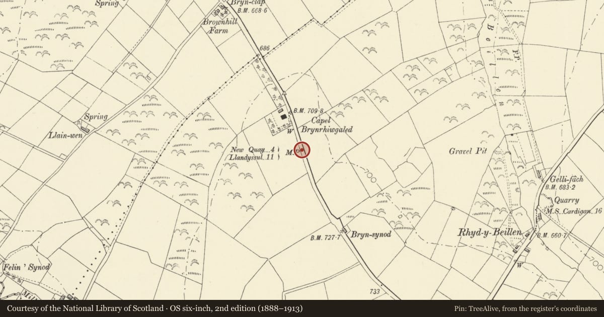
5 historical maps cover this location, the earliest the 1608 map "(13) Cambriae Typus." (David Rumsey Map Collection, Stanford Libraries).
Historical maps covering this location
- 1608 · (13) Cambriae Typus. (David Rumsey Map Collection, Stanford Libraries)
- 1830 · V.3:11-15:XV. Britisches Reich. A. Kon: England. b. Frstenthum Wales: Shire: 37-40 (David Rumsey Map Collection, Stanford Libraries)
- 1899 · 194 Llangranog (Hills) (David Rumsey Map Collection, Stanford Libraries)
- 1901 · Sheet 14. (David Rumsey Map Collection, Stanford Libraries)
- 1919 · Sheet 78. Lampeter. (David Rumsey Map Collection, Stanford Libraries)
Cadw's description
Location
Situated on W side, some 100m S of Brynrhiwgaled chapel
History
Mid C19 milepost of the type used on New Quay to Llandysul road. These were generally made by the Eagle Foundry, Aberystwyth.
Exterior
Painted cast-iron milepost, triangular plan with two faces, marked: " NEW QUAY 4 MILES and LLANDYSSUL 11 MILES". Triangular sloping top and roll edges.
Reason for designation
Included as relic of transport history.
Nearby in the register
- Milestone outside DolcoedTransportunder 1 mi
- Melyn Synod, Synod MillIndustrialunder 1 mi
- Milestone near Blaen-waun fawrTransportunder 1 mi
- Milestone SE of Croesheddig Hen FarmTransportunder 1 mi
Other entries of the same register within about three miles of this one, by straight line.