Cof Cymru: National Historic Assets of Wales · Wales
Coach-house and Stable Range at the Vicarage
Llanarth, Ceredigion, Wales
A Grade II listed building in Llanarth, Ceredigion, designated on 16 February 1996.
The record
- Designation
- Listed building, Grade II
- Broad class
- Domestic
- Date of designation
- 16 February 1996
- Locality
- Llanarth
- Community
- Llanarth
- Unitary authority
- Ceredigion
- Country
- Wales
- Coordinates
- 52.19514, -4.31165
- Cadw reference
- 17720
Slide toward Today to fade the historical sheet and see the modern map underneath.
David Rumsey Map Collection, Stanford LibrariesDavid Rumsey Map Collection, Stanford LibrariesDavid Rumsey Map Collection, Stanford LibrariesDavid Rumsey Map Collection, Stanford LibrariesDavid Rumsey Map Collection, Stanford Libraries
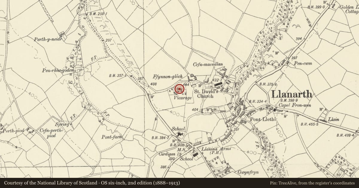
5 historical maps cover this location, the earliest the 1608 map "(13) Cambriae Typus." (David Rumsey Map Collection, Stanford Libraries).
Historical maps covering this location
- 1608 · (13) Cambriae Typus. (David Rumsey Map Collection, Stanford Libraries)
- 1830 · V.3:11-15:XV. Britisches Reich. A. Kon: England. b. Frstenthum Wales: Shire: 37-40 (David Rumsey Map Collection, Stanford Libraries)
- 1899 · 194 Llangranog (Hills) (David Rumsey Map Collection, Stanford Libraries)
- 1901 · Sheet 14. (David Rumsey Map Collection, Stanford Libraries)
- 1919 · Sheet 78. Lampeter. (David Rumsey Map Collection, Stanford Libraries)
Cadw's description
Location
Situated immediately N of The Vicarage
History
1862 lofted coach-house and stable with ancillary outbuildings. By R.J.Withers, contemporary with The Vicarage.
Exterior
Sandstone rubble with tooled sandstone dressings and slate roofs. Lofted main range with W end battered stack. Ground floor stable to left and centre with window, ledged door and window, all with segmental-pointed heads and chamfered jambs. Flush stone windowsills. Over door, under eaves is broad boarded loft door with similar chamfered jambs. To right is broad cambered-arched coach-entry. Boarded loft window above, set higher than loft door over stable, the window with chamfered stone lintel, and breaking through eaves under stone gable.
Attached to left is single-storey range with one broad segmental-pointed door to right, and W end gable with broad segmental-pointed boarded window and vent loop in gable. Courtyard screen-wall (listed with The Vicarage) is attached to SW angle.
Right end has single-storey range, hipped to W with door between two small windows, all with chamfered lintels.
Reason for designation
Group value with The Vicarage, and a good example of Victorian asymmetrical design in its own right.
Nearby in the register
- The VicarageDomesticunder 1 mi
- Church of Saint DavidReligious, Ritual and Funeraryunder 1 mi
- Llanarth VillaDomesticunder 1 mi
- Former National SchoolEducationunder 1 mi
Other entries of the same register within about three miles of this one, by straight line.