Cof Cymru: National Historic Assets of Wales · Wales
Greenbank
Gresford, Wrexham, Wales
A Grade II listed building in Gresford, Wrexham, designated on 3 June 1996.
The record
- Designation
- Listed building, Grade II
- Broad class
- Domestic
- Date of designation
- 3 June 1996
- Locality
- Gresford
- Community
- Gresford
- Unitary authority
- Wrexham
- Country
- Wales
- Coordinates
- 53.08256, -2.96603
- Cadw reference
- 17679
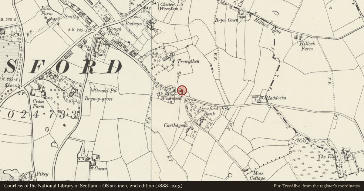
Slide toward Today to fade the historical sheet and see the modern map underneath.
David Rumsey Map Collection, Stanford LibrariesDavid Rumsey Map Collection, Stanford LibrariesDavid Rumsey Map Collection, Stanford LibrariesDavid Rumsey Map Collection, Stanford LibrariesDavid Rumsey Map Collection, Stanford Libraries
5 historical maps cover this location, the earliest the 1608 map "(13) Cambriae Typus." (David Rumsey Map Collection, Stanford Libraries).
Historical maps covering this location
- 1608 · (13) Cambriae Typus. (David Rumsey Map Collection, Stanford Libraries)
- 1637 · Particular description of Wales. Cambria seu Wallia (David Rumsey Map Collection, Stanford Libraries)
- 1883 · Watershed map England, Wales 3. (David Rumsey Map Collection, Stanford Libraries)
- 1898 · 121 Wrexham (Hills) (David Rumsey Map Collection, Stanford Libraries)
- 1901 · Sheet 9 and 10. (David Rumsey Map Collection, Stanford Libraries)
Cadw's description
Location
Situated on the N side of Vicarage Lane on the S edge of the village.
History
Probably built early-mid C19 incorporating earlier work in the picturesque style of the Trevalyn Estate buildings of Marford suggesting it may have had connections with the estate. C20 alterations.
Exterior
Cottage Orne style. Render, slate roof, rendered chimneys, single storey and single storey with attic. Butterfly type plan. Entrance elevation consists of gabled ranges at right angles with a low flat-roofed porch set in the angles flanked on either side by lower 2-window ranges. Porch has dentil cornice and a central door with upper sidelights. Swept up roofs at the gable ends and gables have dentil cornices which return a short distance at eaves level to suggest a pediment. Rear elevation: the V shaped taller range has gabled dormer windows with dentil decoration, left hand side has an entrance with steeply gabled porch with dentil cornice. A door is situated in the low attached left hand range. All windows have been renewed and are leaded and multipaned, some in Gothic style.
Interior
Not accessible at time of 1995 survey.
Reason for designation
Listed as a good example of a house with an inventive plan form in the picturesque style of the Trevalyn Estate buildings at Marford.
Nearby in the register
- Base of CrossReligious, Ritual and Funeraryunder 1 mi
- All Saints Primary SchoolEducationunder 1 mi
- No 3 of 3 Graves in the Graveyard to SE of All Saints ChurchReligious, Ritual and Funeraryunder 1 mi
- Schoolhouse and attached Walls and gatepiersEducationunder 1 mi
Other entries of the same register within about three miles of this one, by straight line.