Cof Cymru: National Historic Assets of Wales · Wales
Orfa-ddu
Ciliau Aeron, Ceredigion, Wales
A Grade II listed building in Cilcennin, Ciliau Aeron, Ceredigion, designated on 23 May 1996.
The record
- Designation
- Listed building, Grade II
- Broad class
- Domestic
- Date of designation
- 23 May 1996
- Locality
- Cilcennin
- Community
- Ciliau Aeron
- Unitary authority
- Ceredigion
- Country
- Wales
- Coordinates
- 52.23078, -4.16829
- Cadw reference
- 17532
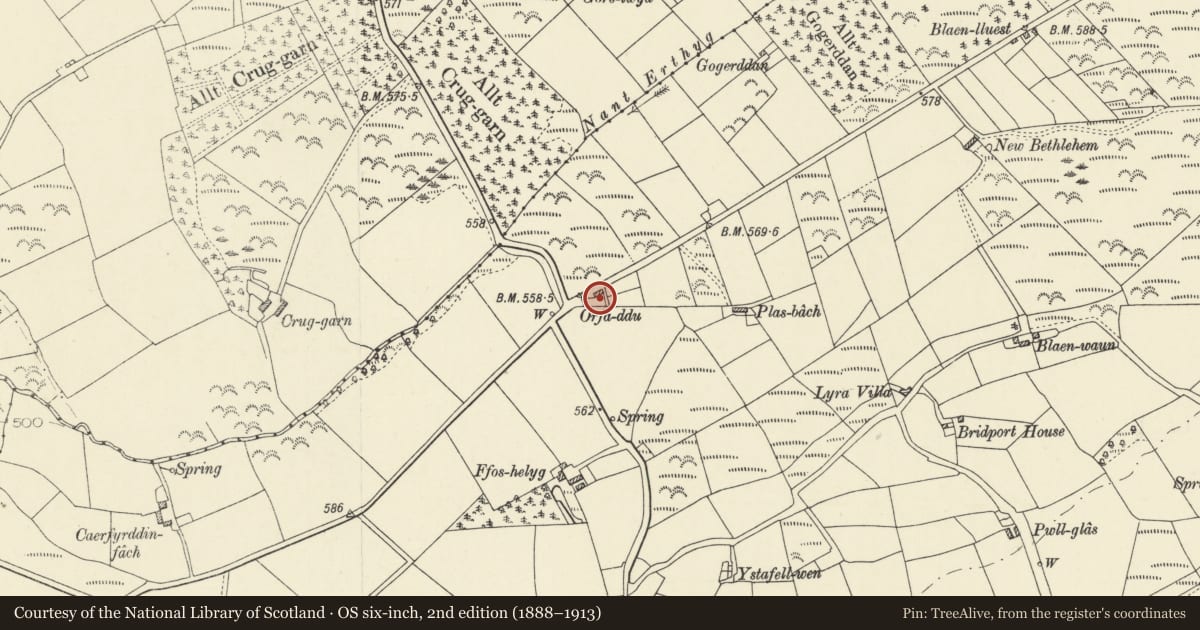
Slide toward Today to fade the historical sheet and see the modern map underneath.
David Rumsey Map Collection, Stanford LibrariesDavid Rumsey Map Collection, Stanford LibrariesDavid Rumsey Map Collection, Stanford LibrariesDavid Rumsey Map Collection, Stanford LibrariesDavid Rumsey Map Collection, Stanford Libraries
5 historical maps cover this location, the earliest the 1608 map "(13) Cambriae Typus." (David Rumsey Map Collection, Stanford Libraries).
Historical maps covering this location
- 1608 · (13) Cambriae Typus. (David Rumsey Map Collection, Stanford Libraries)
- 1830 · V.3:11-15:XV. Britisches Reich. A. Kon: England. b. Frstenthum Wales: Shire: 37-40 (David Rumsey Map Collection, Stanford Libraries)
- 1848 · 57. Tregaron, SW Quad. (David Rumsey Map Collection, Stanford Libraries)
- 1901 · Sheet 14. (David Rumsey Map Collection, Stanford Libraries)
- 1919 · Sheet 78. Lampeter. (David Rumsey Map Collection, Stanford Libraries)
Cadw's description
Location
Situated immediately E of staggered cross-junction of minor roads, 0.5km N of Cilcennin.
History
Early C19, shown on 1843 Tithe map: owner, David Evans and Evan George, occupier.
Exterior
Mainly rubble construction, but gable walls chiefly of cob (some concrete block patching to left). Slate roof, replaced in corrugated iron to front slope. Low brick chimney stack set slightly back from right gable. Single storey two bay elevation. Doorway to left and window to right, the latter with stone sill and inserted glazing: timber lintels. Plain ends, that to right on bank of small stream. Small window to rear gable, timber lintel.
Interior
Unusual single-room plan, probably part-lofted. Fireplace hood of timber lath construction upon pole beam. Free-standing brick bread oven. Rough pole cross-beam. Three bay collar-truss roof, pegged joints.
Reason for designation
Listed as a very unusual (in this region) single room cottage of part-cob construction.
Nearby in the register
- The Old VicarageDomesticunder 1 mi
- GlendowerDomesticunder 1 mi
- Attached Cottage to S of GlendowerDomesticunder 1 mi
- The Commercial InnCommercialunder 1 mi
Other entries of the same register within about three miles of this one, by straight line.