Cof Cymru: National Historic Assets of Wales · Wales
Barn range an W side of farmyard at Ty Glyn
Dyffryn Arth, Ceredigion, Wales
A Grade II listed building in Ty Glyn, Dyffryn Arth, Ceredigion, designated on 23 May 1996.
The record
- Designation
- Listed building, Grade II
- Broad class
- Agriculture and Subsistence
- Date of designation
- 23 May 1996
- Locality
- Ty Glyn
- Community
- Dyffryn Arth
- Unitary authority
- Ceredigion
- Country
- Wales
- Coordinates
- 52.21727, -4.19928
- Cadw reference
- 17512
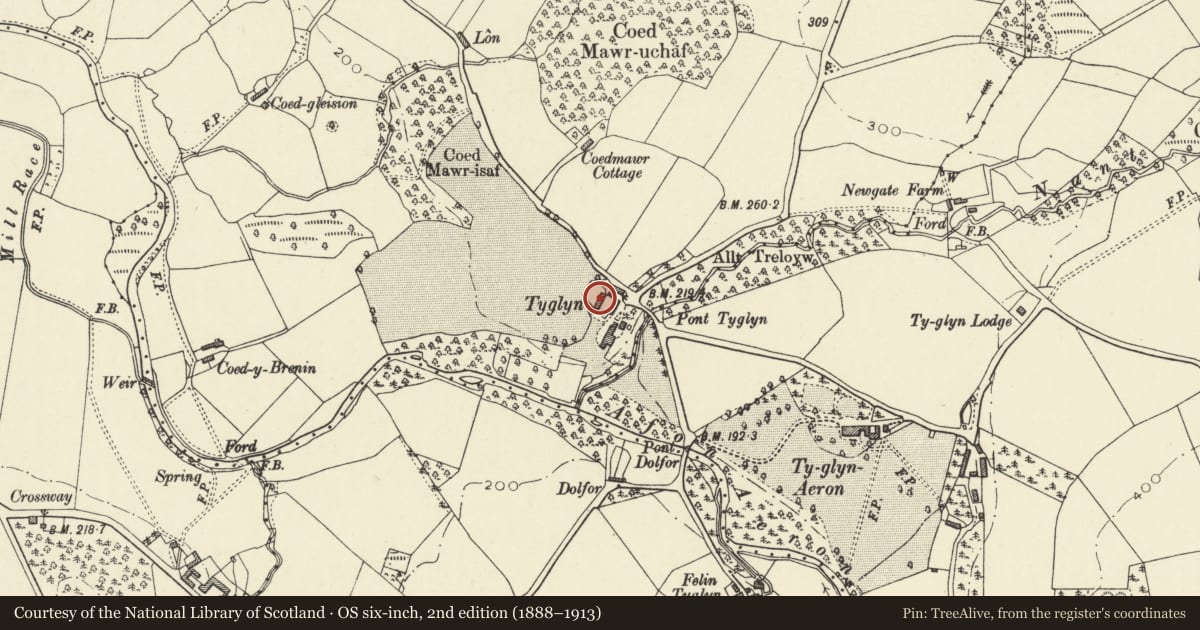
Slide toward Today to fade the historical sheet and see the modern map underneath.
David Rumsey Map Collection, Stanford LibrariesDavid Rumsey Map Collection, Stanford LibrariesDavid Rumsey Map Collection, Stanford LibrariesDavid Rumsey Map Collection, Stanford LibrariesDavid Rumsey Map Collection, Stanford Libraries
5 historical maps cover this location, the earliest the 1608 map "(13) Cambriae Typus." (David Rumsey Map Collection, Stanford Libraries).
Historical maps covering this location
- 1608 · (13) Cambriae Typus. (David Rumsey Map Collection, Stanford Libraries)
- 1830 · V.3:11-15:XV. Britisches Reich. A. Kon: England. b. Frstenthum Wales: Shire: 37-40 (David Rumsey Map Collection, Stanford Libraries)
- 1848 · 57. Tregaron, SW Quad. (David Rumsey Map Collection, Stanford Libraries)
- 1901 · Sheet 14. (David Rumsey Map Collection, Stanford Libraries)
- 1919 · Sheet 78. Lampeter. (David Rumsey Map Collection, Stanford Libraries)
Cadw's description
Location
Situated along W side of farm-yard, NW of Ty Glyn.
Exterior
History: Barn and attached outbuilding, probably later C18, from roof type, but not marked on 1843 Tithe Map, possibly in error.
Exterior: Rubble stone with slate roof. Tall single range with centre tall cambered-headed doorway with brick arch and double ledged doors with chamfered centre post. Vent loop each side. Rear wall cambered-arched doorway with double doors and stone voussoirs.
Added N end low building with asbestos roof and one timber-lintel door. Loading door at N end with timber lintel.
Interior: Five-bay roof with pegged collar-trusses and scarfed wall-posts, face-pegged. Triple purlins. Three vent loops at lower end, six at upper end. Added N range has three-bay roof with scarfed collar trusses.
A well-preserved later C18 barn with scarfed roof trusses. Group value with other listed buildings in the farmyard.
Reference: Royal Commission on Historic Monuments, Aberystwyth.
Nearby in the register
- Granary at S end of farmyard at Ty GlynAgriculture and Subsistenceunder 1 mi
- Stable range on E side of farm yard at Ty GlynDomesticunder 1 mi
- Gates and railings to driveway at Ty GlynDomesticunder 1 mi
- Brewhouse to NE of Ty GlynDomesticunder 1 mi
Other entries of the same register within about three miles of this one, by straight line.