Cof Cymru: National Historic Assets of Wales · Wales
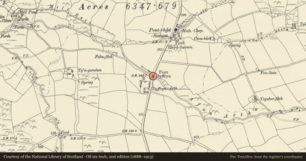
Pont Dyffryn
Dyffryn Arth, Ceredigion, Wales
A Grade II listed building in Pontrhydsaeson, Dyffryn Arth, Ceredigion, designated on 23 May 1996.
The record
- Designation
- Listed building, Grade II
- Broad class
- Transport
- Date of designation
- 23 May 1996
- Locality
- Pontrhydsaeson
- Community
- Dyffryn Arth
- Unitary authority
- Ceredigion
- Country
- Wales
- Coordinates
- 52.24469, -4.13732
- Cadw reference
- 17505
Slide toward Today to fade the historical sheet and see the modern map underneath.
David Rumsey Map Collection, Stanford LibrariesDavid Rumsey Map Collection, Stanford LibrariesDavid Rumsey Map Collection, Stanford LibrariesDavid Rumsey Map Collection, Stanford LibrariesDavid Rumsey Map Collection, Stanford Libraries
5 historical maps cover this location, the earliest the 1830 map "V.3:11-15:XV. Britisches Reich. A. Kon: England. b. Frstenthum Wales: Shire: 37-40" (David Rumsey Map Collection, Stanford Libraries).
Historical maps covering this location
- 1830 · V.3:11-15:XV. Britisches Reich. A. Kon: England. b. Frstenthum Wales: Shire: 37-40 (David Rumsey Map Collection, Stanford Libraries)
- 1896 · Sheet 7. Ordnance Survey of England and Wales. (David Rumsey Map Collection, Stanford Libraries)
- 1899 · 178 Llanilar (Hills) (David Rumsey Map Collection, Stanford Libraries)
- 1901 · Sheet 14. (David Rumsey Map Collection, Stanford Libraries)
- 1919 · Sheet 78. Lampeter. (David Rumsey Map Collection, Stanford Libraries)
Cadw's description
Location
Situated on B 4377 some 300m S of Pontrhydsaeson, over the Arth.
Exterior
History: 1847 road bridge, by Thomas Penson, one of three distinctive masonry bridges on the approach to Pontrhydsaeson, the other two being Pont Rhydsaeson and Pont Glanbran.
Description: Squared rubble stone single-arched bridge with shallow elliptical arch. Raised rectangular voussoirs to arch and large raised keystone. Flat raised band over keystone and under flat parapet with heavy squared coping stones. The ends are curved out slightly to raised piers with band carried across.
Included as one of a distinctive group of masonry bridges of unusual quality this region, designed by Thomas Penson and his son R.K. Penson, including Pont Aberarth 1849, Pont Pennant 1850, Pont Rhydsaeson and Pont Glanbran.
Reference: Pembrokeshire Herald 31/12/1847 Rebuilt to plan of Thomas Penson of Oswestry, David Morgan of Cardigan builder. 32' span, elliptical arch.
Nearby in the register
- Dyffryn ArthDomesticunder 1 mi
- Pont RhydsaesonTransportunder 1 mi
- Milestone on B4337Transportunder 1 mi
- Pont Glanbran ( Partly in Ciliau Aeron Community)Transportunder 1 mi
Other entries of the same register within about three miles of this one, by straight line.