Cof Cymru: National Historic Assets of Wales · Wales
Cottage at entrance to Cilerwysg
Llanfihangel Ystrad, Ceredigion, Wales
A Grade II listed building in Cwm Wysag, Lampeter, Llanfihangel Ystrad, Ceredigion, designated on 18 October 1996.
The record
- Designation
- Listed building, Grade II
- Broad class
- Domestic
- Date of designation
- 18 October 1996
- Locality
- Cwm Wysag
- Town
- Lampeter
- Community
- Llanfihangel Ystrad
- Unitary authority
- Ceredigion
- Country
- Wales
- Coordinates
- 52.16643, -4.09706
- Cadw reference
- 17441
Slide toward Today to fade the historical sheet and see the modern map underneath.
David Rumsey Map Collection, Stanford LibrariesDavid Rumsey Map Collection, Stanford LibrariesDavid Rumsey Map Collection, Stanford LibrariesDavid Rumsey Map Collection, Stanford LibrariesDavid Rumsey Map Collection, Stanford Libraries
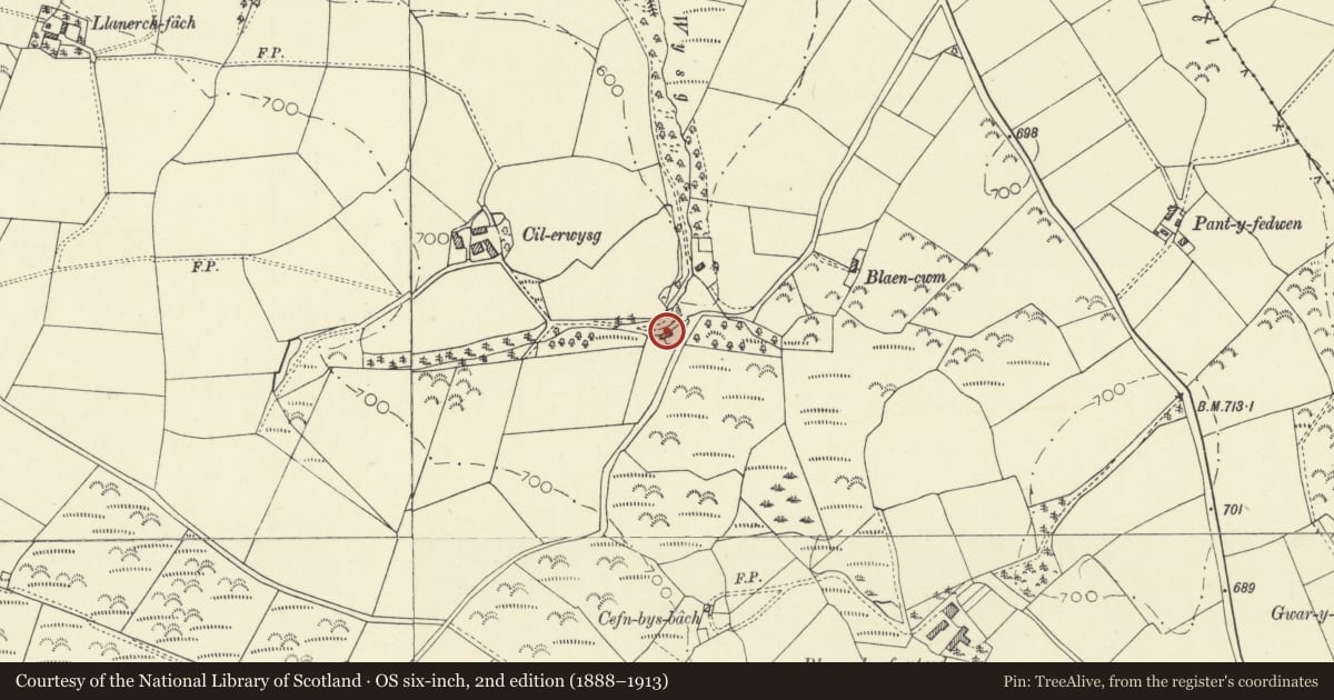
5 historical maps cover this location, the earliest the 1608 map "(13) Cambriae Typus." (David Rumsey Map Collection, Stanford Libraries).
Historical maps covering this location
- 1608 · (13) Cambriae Typus. (David Rumsey Map Collection, Stanford Libraries)
- 1830 · V.3:11-15:XV. Britisches Reich. A. Kon: England. b. Frstenthum Wales: Shire: 37-40 (David Rumsey Map Collection, Stanford Libraries)
- 1899 · 195 Lampeter (Hills) (David Rumsey Map Collection, Stanford Libraries)
- 1901 · Sheet 14. (David Rumsey Map Collection, Stanford Libraries)
- 1919 · Sheet 78. Lampeter. (David Rumsey Map Collection, Stanford Libraries)
Cadw's description
Location
Situated on W side of by-road at entrance to Cilerwysg, some 2.5km NE of Pont Creuddyn.
History
Early C19, shown on 1843 Tithe map, when it belonged to the Owen family of Cilerwysg.
Exterior
Whitewashed rubble single storey cottage. Corrugated-iron roof, concealing thatch. Boarded projecting eaves. Rubble gable chimney stack to right. Left chimney removed. Three-bay front, offset to right. Two-light 4-pane casements and boarded central door, timber lintels. Left end with two small windows each side of central blocked door (the latter probably replacing a fireplace). Left gable with with overlapping iron sheets. Right gable end partly collapsed with ruined additon, partly of red brick. Window to rear.
Interior
The interior was not inspected.
Condition deteriorating at the time of inspection (January 1996).
Reason for designation
Listed as an early C19 single-storey cottage with regional character.
Nearby in the register
- Pen Clawdd-Mawr Defended EnclosurePromontory Fort - inland1 mi
- Milestone on E side of A482Transport1 mi
- Former farmhouse and cowshed at Trefynor IsafAgriculture and Subsistence1 mi
- Outbuilding range at Trefynor-IsafAgriculture and Subsistence2 mi
Other entries of the same register within about three miles of this one, by straight line.