Cof Cymru: National Historic Assets of Wales · Wales
Outbuilding range at Trefynor-Isaf
Nantcwnlle, Ceredigion, Wales
A Grade II listed building in Gartheli, Lampeter, Nantcwnlle, Ceredigion, designated on 29 May 2002.
The record
- Designation
- Listed building, Grade II
- Broad class
- Agriculture and Subsistence
- Date of designation
- 29 May 2002
- Locality
- Gartheli
- Town
- Lampeter
- Community
- Nantcwnlle
- Unitary authority
- Ceredigion
- Country
- Wales
- Coordinates
- 52.18568, -4.08047
- Cadw reference
- 26697
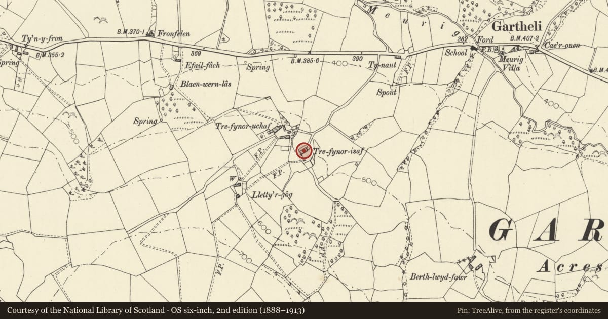
Slide toward Today to fade the historical sheet and see the modern map underneath.
David Rumsey Map Collection, Stanford LibrariesDavid Rumsey Map Collection, Stanford LibrariesDavid Rumsey Map Collection, Stanford LibrariesDavid Rumsey Map Collection, Stanford LibrariesDavid Rumsey Map Collection, Stanford Libraries
5 historical maps cover this location, the earliest the 1608 map "(13) Cambriae Typus." (David Rumsey Map Collection, Stanford Libraries).
Historical maps covering this location
- 1608 · (13) Cambriae Typus. (David Rumsey Map Collection, Stanford Libraries)
- 1830 · V.3:11-15:XV. Britisches Reich. A. Kon: England. b. Frstenthum Wales: Shire: 37-40 (David Rumsey Map Collection, Stanford Libraries)
- 1899 · 195 Lampeter (Hills) (David Rumsey Map Collection, Stanford Libraries)
- 1901 · Sheet 14. (David Rumsey Map Collection, Stanford Libraries)
- 1919 · Sheet 78. Lampeter. (David Rumsey Map Collection, Stanford Libraries)
Cadw's description
Location
Situated to the right of the present farmhouse, on N side of the farmyard at Trefynor Isaf, which is approached by a drive of some 400m running SW from Abermeurig-Llwynygroes road from a point just SW of Tynant.
History
Shown on a map of 1801; roof-line perhaps raised in Mid-to-late C19. The range consists of lofted cart house and stable to L, with attached barn to R.
Exterior
Agricultural range, part lofted. Stone and clay walls, whitewashed. Stone lower walls about 1.8m high, upper parts of walls in clay, eaves raised in clay reinforced with rough timber; corrugated roof covering. At L end is part-blocked cart entry, then doorway; to R again, further doorway with canopy above. At right end, at eaves level, loading door; small window below. Right gable has ventilation slits; left gable has loading door at loft level. Rear of barn has doorway opposed to that at front.
Interior
The left end is lofted with wooden stalls. Stable and barn are separated by stone wall to loft height.
Reason for designation
A C18 farm building in traditional Cardiganshire materials which has Group Value with old farmhouse at Trefynor-Isaf.
Nearby in the register
- Former farmhouse and cowshed at Trefynor IsafAgriculture and Subsistenceunder 1 mi
- TynantDomesticunder 1 mi
- Outbuilding at DolwerddDomesticunder 1 mi
- DolwerddDomesticunder 1 mi
Other entries of the same register within about three miles of this one, by straight line.