Cof Cymru: National Historic Assets of Wales · Wales
The Forge
Glasbury, Powys, Wales
A Grade II listed building in Boughrood, Glasbury, Powys, designated on 18 January 1996.
The record
- Designation
- Listed building, Grade II
- Broad class
- Domestic
- Date of designation
- 18 January 1996
- Locality
- Boughrood
- Community
- Glasbury
- Unitary authority
- Powys
- Country
- Wales
- Coordinates
- 52.04560, -3.27247
- Cadw reference
- 17184
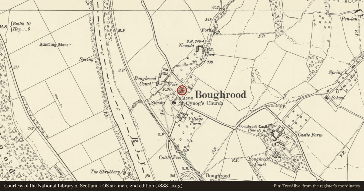
Slide toward Today to fade the historical sheet and see the modern map underneath.
David Rumsey Map Collection, Stanford LibrariesDavid Rumsey Map Collection, Stanford LibrariesDavid Rumsey Map Collection, Stanford LibrariesDavid Rumsey Map Collection, Stanford LibrariesDavid Rumsey Map Collection, Stanford Libraries
5 historical maps cover this location, the earliest the 1608 map "(13) Cambriae Typus." (David Rumsey Map Collection, Stanford Libraries).
Historical maps covering this location
- 1608 · (13) Cambriae Typus. (David Rumsey Map Collection, Stanford Libraries)
- 1636 · Cornubia : Devonia, Somersetus, Dorcestria, Wiltonia, Glocestria ... (David Rumsey Map Collection, Stanford Libraries)
- 1856 · 42. Brecon. (David Rumsey Map Collection, Stanford Libraries)
- 1896 · 214 Talgarth (Hills) (David Rumsey Map Collection, Stanford Libraries)
- 1901 · Sheet 14. (David Rumsey Map Collection, Stanford Libraries)
Cadw's description
Location
Located on the perimeter road around Boughrood Churchyard, N of the church.
Exterior
Cottage of the C16-C17, altered in the C19, when the adjacent blacksmith's forge was in operation. Whitewashed stone with a slate roof. One storey and attic, 3 bays, with a lean-to at the SW end. C19 casement windows with timber lintels, and 3 raised and gabled dormers with casement windows on each side, one at the NE end of the NW side added in the later C20. The SE elevation has larger windows and lean-to conservatory. Wall partially battered. Entrance now through lean-to to door at side of the gable stack.
Interior
Gable entrance at the side of stack with heavy chamfered fire beam extending and slightly arched over a cupboard or early stair on left. Chamfered cross beams. Timber-framed partition built into pair of raised crucks, which have half-dovetails for the tie and collar beams, both now removed. Vertically abutted apex notched for diagonally set ridge.
Reason for designation
Included as one of the best surviving examples of the sub-medieval cruck-built houses placed around the churchyard at Boughrood.
Nearby in the register
- Bier House at Church of St CynogNo class recordedunder 1 mi
- Church of St CynogReligious, Ritual and Funeraryunder 1 mi
- Barn and cowhouse range formerly with Village FarmAgriculture and Subsistenceunder 1 mi
- Village FarmhouseDomesticunder 1 mi
Other entries of the same register within about three miles of this one, by straight line.