Cof Cymru: National Historic Assets of Wales · Wales
Gardener's cottage at Gwernyfed High School (Gwernyfed Park)
Gwernyfed, Powys, Wales
A Grade II listed building in Aberllynfi, Gwernyfed, Powys, designated on 15 December 1995.
The record
- Designation
- Listed building, Grade II
- Broad class
- Domestic
- Date of designation
- 15 December 1995
- Locality
- Aberllynfi
- Community
- Gwernyfed
- Unitary authority
- Powys
- Country
- Wales
- Coordinates
- 52.02815, -3.20634
- Cadw reference
- 17050
Slide toward Today to fade the historical sheet and see the modern map underneath.
David Rumsey Map Collection, Stanford LibrariesDavid Rumsey Map Collection, Stanford LibrariesDavid Rumsey Map Collection, Stanford LibrariesDavid Rumsey Map Collection, Stanford LibrariesDavid Rumsey Map Collection, Stanford Libraries
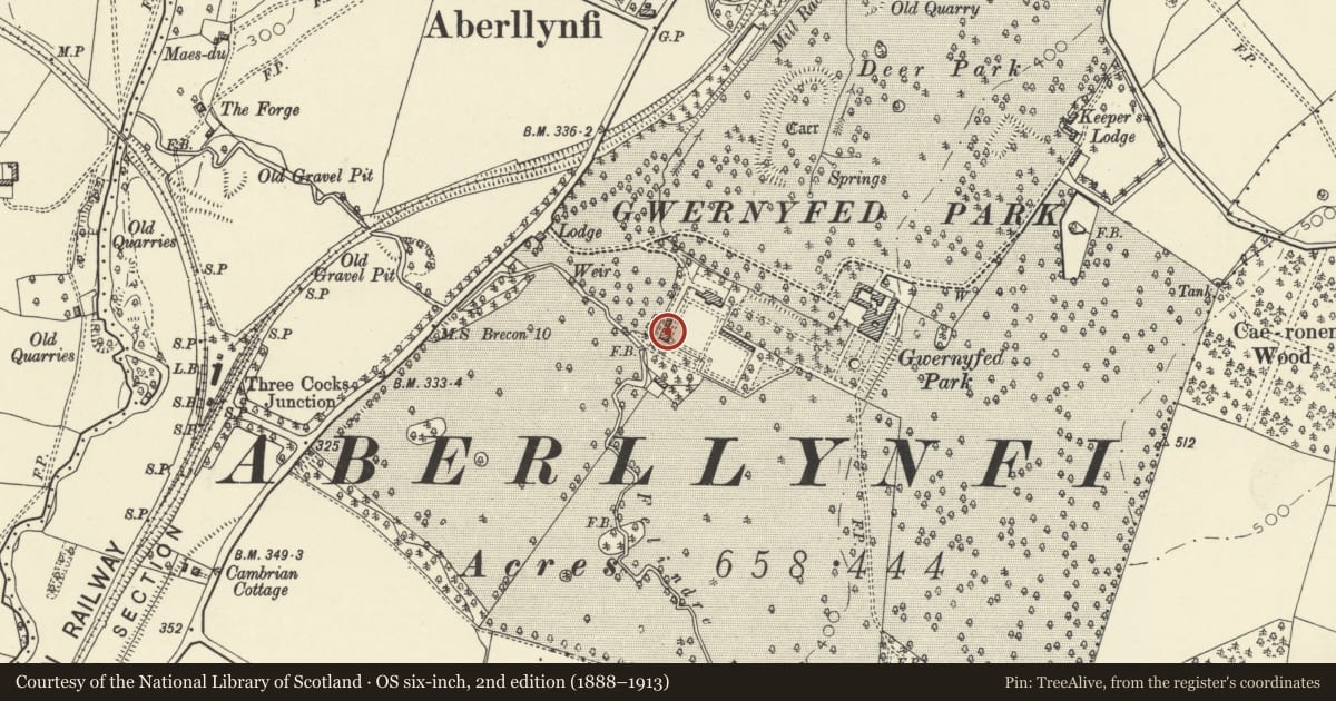
5 historical maps cover this location, the earliest the 1608 map "(13) Cambriae Typus." (David Rumsey Map Collection, Stanford Libraries).
Historical maps covering this location
- 1608 · (13) Cambriae Typus. (David Rumsey Map Collection, Stanford Libraries)
- 1636 · Cornubia : Devonia, Somersetus, Dorcestria, Wiltonia, Glocestria ... (David Rumsey Map Collection, Stanford Libraries)
- 1856 · 42. Brecon. (David Rumsey Map Collection, Stanford Libraries)
- 1896 · 214 Talgarth (Hills) (David Rumsey Map Collection, Stanford Libraries)
- 1901 · Sheet 14. (David Rumsey Map Collection, Stanford Libraries)
Cadw's description
Location
Located at the SW corner of the kitchen garden of the former Gwernyfed Park facing towards the main Hay to Brecon road.
History
Estate cottage probably by W Eden Nesfield c1880.
Exterior
Grey sandstone rubble with limestone dressings and tiled roof. Two storeys 'Z'-plan, comprising a wing on the right side of front and back elevations, an open arched porch with side light under a low hipped roof in the re-entrant angle on the E, and stair under a continuation of the main roof in the equivalent angle on the W. Two-storey square bay to E facing wing, with stone mullioned windows, transomed to ground floor, and roof hipped. Brick stacks.
Attached to the E front, the 3m high SW wall of the kitchen garden, with brick offset courses and tiled coping.
Reason for designation
Included as of group value with the kitchen garden and glasshouse at the Grade II* former Gwernyfed Park.
Nearby in the register
- Glasshouses in kitchen garden at Gwernyfed High SchoolDomesticunder 1 mi
- Kitchen garden walls, gatepiers and gates at Gwernyfed High SchoolEducationunder 1 mi
- Continuation walls to Gwernyfed High School LodgeDomesticunder 1 mi
- Lodge Gates and screen to Gwernyfed High SchoolDomesticunder 1 mi
Other entries of the same register within about three miles of this one, by straight line.