Cof Cymru: National Historic Assets of Wales · Wales
Ty Capel adjoining Salem Baptist Chapel
Llansanffraid Glan Conwy, Conwy, Wales
A Grade II listed building in Pentrefelin, Llansanffraid Glan Conwy, Conwy, designated on 5 January 1996.
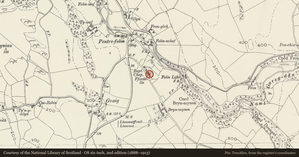
The record
- Designation
- Listed building, Grade II
- Broad class
- Religious, Ritual and Funerary
- Date of designation
- 5 January 1996
- Locality
- Pentrefelin
- Community
- Llansanffraid Glan Conwy
- Unitary authority
- Conwy
- Country
- Wales
- Coordinates
- 53.25413, -3.79203
- Cadw reference
- 17044
Slide toward Today to fade the historical sheet and see the modern map underneath.
David Rumsey Map Collection, Stanford LibrariesDavid Rumsey Map Collection, Stanford LibrariesDavid Rumsey Map Collection, Stanford LibrariesLlyfrgell Genedlaethol Cymru – The National Library of WalesDavid Rumsey Map Collection, Stanford Libraries
5 historical maps cover this location, the earliest the 1795 map "To Sir Watkin Williams-Wynn Bart ... the map of the six counties of North Wales is most humbly inscribed by his obedient humble servant" (Llyfrgell Genedlaethol Cymru – The National Library of Wales).
Historical maps covering this location
- 1795 · To Sir Watkin Williams-Wynn Bart ... the map of the six counties of North Wales is most… (Llyfrgell Genedlaethol Cymru – The National Library of Wales)
- 1830 · V.3:11-15:XV. Britisches Reich. A. Kon: England. b. Frstenthum Wales: Shire: 37-40 (David Rumsey Map Collection, Stanford Libraries)
- 1883 · Watershed map England, Wales 3. (David Rumsey Map Collection, Stanford Libraries)
- 1899 · 106 Bangor (Outline) (David Rumsey Map Collection, Stanford Libraries)
- 1901 · Sheet 9 and 10. (David Rumsey Map Collection, Stanford Libraries)
Cadw's description
Location
Located on the NE side of the Bryn Mynan lane at the S extremity of Pentrefelin; behind a low plain-coped and railed wall.
Exterior
The manse (Ty Capel) adjoins the chapel to the SE (L) and is set back and slightly stepped down. Of 2 storeys, construction as before; stone coped gable parapet to R and plain rendered end chimneys. Symmetrical 2-bay front with central part-glazed door behind plain gabled porch. 16-pane windows as before with framed dedication plaque between those of the first floor. Single-storey and storeyed extensions to the rear.
Interior
The interior was not inspected during the survey (October 1995).
Reason for designation
A mid C19 chapel and manse group with earlier origins and in a prominent road-side location.
Nearby in the register
- Salem Baptist ChapelReligious, Ritual and Funeraryunder 1 mi
- Felin Isaf MillIndustrialunder 1 mi
- Clover MillIndustrialunder 1 mi
- Former Oat Kiln at Felin IsafIndustrialunder 1 mi
Other entries of the same register within about three miles of this one, by straight line.