Cof Cymru: National Historic Assets of Wales · Wales
Kitchen Garden Walls (including glasshouses) at Bryn Eisteddfod
Llansanffraid Glan Conwy, Conwy, Wales
A Grade II listed building in Bryn Eisteddfod, Llansanffraid Glan Conwy, Conwy, designated on 5 January 1996.
The record
- Designation
- Listed building, Grade II
- Broad class
- Domestic
- Date of designation
- 5 January 1996
- Locality
- Bryn Eisteddfod
- Community
- Llansanffraid Glan Conwy
- Unitary authority
- Conwy
- Country
- Wales
- Coordinates
- 53.27567, -3.79081
- Cadw reference
- 17037
Slide toward Today to fade the historical sheet and see the modern map underneath.
David Rumsey Map Collection, Stanford LibrariesDavid Rumsey Map Collection, Stanford LibrariesLlyfrgell Genedlaethol Cymru – The National Library of WalesDavid Rumsey Map Collection, Stanford LibrariesNational Library of Scotland
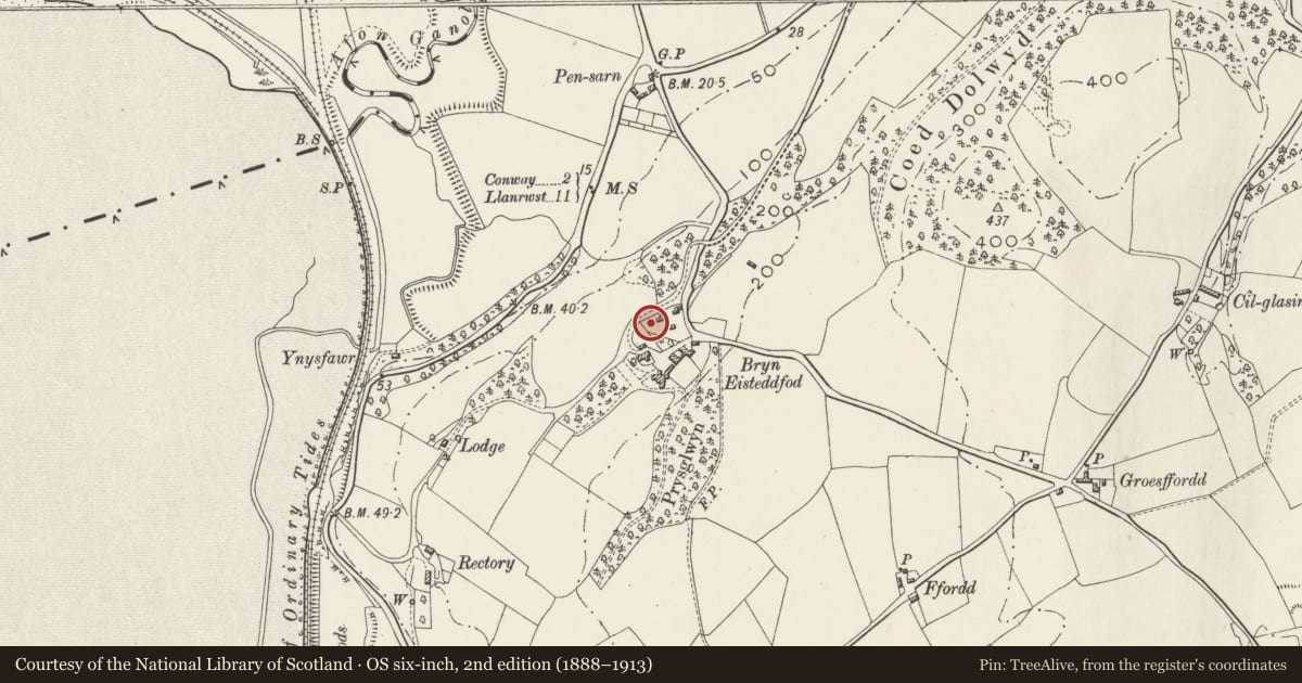
5 historical maps cover this location, the earliest the 1795 map "To Sir Watkin Williams-Wynn Bart ... the map of the six counties of North Wales is most humbly inscribed by his obedient humble servant" (Llyfrgell Genedlaethol Cymru – The National Library of Wales).
Historical maps covering this location
- 1795 · To Sir Watkin Williams-Wynn Bart ... the map of the six counties of North Wales is most… (Llyfrgell Genedlaethol Cymru – The National Library of Wales)
- 1830 · V.3:11-15:XV. Britisches Reich. A. Kon: England. b. Frstenthum Wales: Shire: 37-40 (David Rumsey Map Collection, Stanford Libraries)
- 1883 · Watershed map England, Wales 3. (David Rumsey Map Collection, Stanford Libraries)
- 1901 · Sheet 9 and 10. (David Rumsey Map Collection, Stanford Libraries)
- 1930 · OS Popular Edition 1919-1947 (National Library of Scotland)
Cadw's description
Location
Bounding the lower drive of Bryn Eisteddfod to the N, the service court to the S and the B5381 to the E.
Exterior
C18 and C19 kitchen garden walls, particularly imposing where they border the road. The walls enclose a rectangular area and adjoin the brick carthouse to the rear and to the R. Of 2 sections, those associated with these buildings represent a C19 addition to the earlier (and larger) primary square enclosure; in essence this is of the 1760s and relates to the Jones' new house. The earlier and later sections are linked by a rubble dividing wall; the later section is of rubble, the earlier (typically) of rubble faced internally with brick. The walls have been raised on the N and E (road-facing) sides; In the former section, an 1830s Tudor-arched, chamfered entrance with boarded door. At the corner of the N and E walls, is a blind, chamfered slit-light. Stepped-down to the R, the wall continues to bound the road; here at the continuation, a plain boarded door. The wall slopes down to continue as a plain-railed dwarf wall. The lower S side has a raised, arched entrance to the centre with a boarded, part-latticed door. C20 double gates at the SW corner.
Towards the NE corner, 3 late C19 and early C20 glasshouses; of red brick and timber construction with multi-pane glazing. The central one has wooden ball finials to its gables and has a longer S pitch with raised plinth to the N. That to the R is a long lean-to type, built against the E wall.
Reason for designation
Included for group value with other listed items at Bryn Eisteddfod.
Nearby in the register
- Brick Carthouse at Bryn EisteddfodDomesticunder 1 mi
- Bwthyn-y-Bryn at Bryn EisteddfodDomesticunder 1 mi
- Garages at Bryn EisteddfodDomesticunder 1 mi
- Mews CottageDomesticunder 1 mi
Other entries of the same register within about three miles of this one, by straight line.