Cof Cymru: National Historic Assets of Wales · Wales
The Old Rectory
Llansanffraid Glan Conwy, Conwy, Wales
A Grade II listed building in Llansanffraid Glan Conwy, Conwy, designated on 5 January 1996.
The record
- Designation
- Listed building, Grade II
- Broad class
- Domestic
- Date of designation
- 5 January 1996
- Locality
- Llansanffraid Glan Conwy
- Community
- Llansanffraid Glan Conwy
- Unitary authority
- Conwy
- Country
- Wales
- Coordinates
- 53.27264, -3.79517
- Cadw reference
- 17023
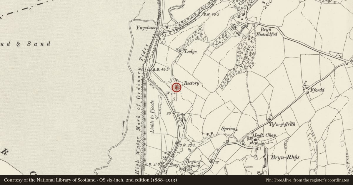
Slide toward Today to fade the historical sheet and see the modern map underneath.
David Rumsey Map Collection, Stanford LibrariesDavid Rumsey Map Collection, Stanford LibrariesDavid Rumsey Map Collection, Stanford LibrariesLlyfrgell Genedlaethol Cymru – The National Library of WalesDavid Rumsey Map Collection, Stanford Libraries
5 historical maps cover this location, the earliest the 1795 map "To Sir Watkin Williams-Wynn Bart ... the map of the six counties of North Wales is most humbly inscribed by his obedient humble servant" (Llyfrgell Genedlaethol Cymru – The National Library of Wales).
Historical maps covering this location
- 1795 · To Sir Watkin Williams-Wynn Bart ... the map of the six counties of North Wales is most… (Llyfrgell Genedlaethol Cymru – The National Library of Wales)
- 1830 · V.3:11-15:XV. Britisches Reich. A. Kon: England. b. Frstenthum Wales: Shire: 37-40 (David Rumsey Map Collection, Stanford Libraries)
- 1883 · Watershed map England, Wales 3. (David Rumsey Map Collection, Stanford Libraries)
- 1899 · 94 Beaumaris (Hills) (David Rumsey Map Collection, Stanford Libraries)
- 1901 · Sheet 9 and 10. (David Rumsey Map Collection, Stanford Libraries)
Cadw's description
Location
Raised up above the road overlooking the Conwy estuary, approximately 0.5km N of the village; accessed from the road via a metalled drive.
Exterior
Early C19, late Georgian rectory with late C19 and modern alterations and additions; the present building appears to be a re-modelling or a replacement of an earlier house, recorded in the second quarter C18. Of roughcast rubble with slate roof and plain end chimneys; deep, plain verges and plain, modern bargeboards. Symmetrical 3-bay entrance front with storeyed, gabled porch. 4-panel Victorian double doors with plain rectangular fanlight and flanking Egyptianising pilasters; modern open porch on Tuscan columns. Above, a slightly-recessed 16-pane early-C19 sash window; similar windows to first floor of flanking bays. Large 12-pane ground-floor flanking windows with expressed flat-arched lintels. Late C19 range to rear, forming an L with the primary block; further sash windows with stucco lintels and stone cills; end chimney, modern extension to rear gable end. Adjoining the main front to the R, a 4-bay single-storey modern extension in Georgian style.
Interior
Plain, largely late C19 or C20 interiors.
Reason for designation
An early C19 rectory retaining good facade.
Nearby in the register
- Top Lodge at Bryn EisteddfodDomesticunder 1 mi
- Bryn EisteddfodDomesticunder 1 mi
- Bwthyn-y-Bryn at Bryn EisteddfodDomesticunder 1 mi
- Garages at Bryn EisteddfodDomesticunder 1 mi
Other entries of the same register within about three miles of this one, by straight line.