Cof Cymru: National Historic Assets of Wales · Wales
Pen-y-Clogwyn
Caerhun, Conwy, Wales
A Grade II listed building in Llanbedr-y-Cennin, Caerhun, Conwy, designated on 21 February 1996.
The record
- Designation
- Listed building, Grade II
- Broad class
- Domestic
- Date of designation
- 21 February 1996
- Locality
- Llanbedr-y-Cennin
- Community
- Caerhun
- Unitary authority
- Conwy
- Country
- Wales
- Coordinates
- 53.20946, -3.85199
- Cadw reference
- 17016
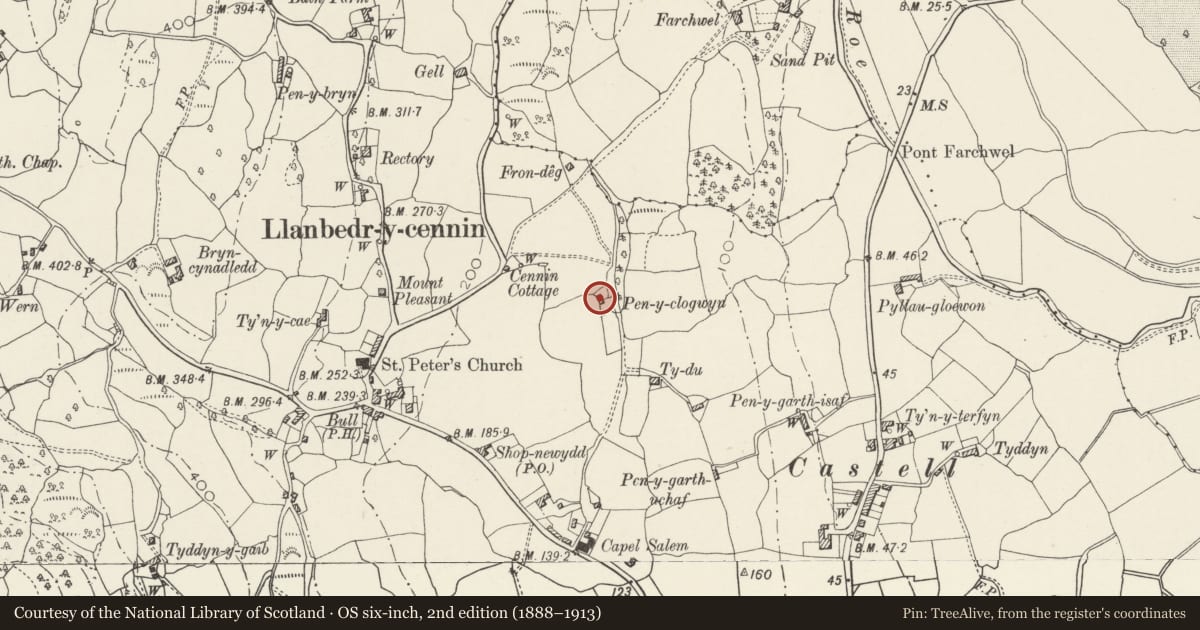
Slide toward Today to fade the historical sheet and see the modern map underneath.
David Rumsey Map Collection, Stanford LibrariesDavid Rumsey Map Collection, Stanford LibrariesDavid Rumsey Map Collection, Stanford LibrariesDavid Rumsey Map Collection, Stanford LibrariesDavid Rumsey Map Collection, Stanford Libraries
5 historical maps cover this location, the earliest the 1883 map "Watershed map England, Wales 3." (David Rumsey Map Collection, Stanford Libraries).
Historical maps covering this location
- 1883 · Watershed map England, Wales 3. (David Rumsey Map Collection, Stanford Libraries)
- 1896 · Sheet 7. Ordnance Survey of England and Wales. (David Rumsey Map Collection, Stanford Libraries)
- 1899 · 106 Bangor (Hills) (David Rumsey Map Collection, Stanford Libraries)
- 1899 · 106 Bangor (Outline) (David Rumsey Map Collection, Stanford Libraries)
- 1901 · Sheet 9 and 10. (David Rumsey Map Collection, Stanford Libraries)
Cadw's description
Location
Located approximately 0.6km ENE of Llanbedr church in an isolated position adjoining a burial ground to the S; sited slightly above a lane running N from the Capel Salem at Llanbedr, on top of a low rock outcrop.
Exterior
Second-half C18 vernacular pair of single-storey reflected cottages, now one dwelling; part rock-built and with boulder foundations. Of whitened rubble with old slate roof and plain, squat end chimneys. Each unit has a central entrance with boarded stable doors and glazed upper panel; this is flanked by late C19 4-pane sashes contained within the original small openings. Modern extensions to both gable ends and modern windows to the rear, one to each former cottage.
Interior
Each unit was formerly of 2 bays; one crude pegged collar truss survives to that to L, otherwise the roof structure is early C20.
Reason for designation
Included for its special interest as a former pair of reflected cottages of C18 origin
Nearby in the register
- Church CottageDomesticunder 1 mi
- Parish Church of St PeterReligious, Ritual and Funeraryunder 1 mi
- Church HouseDomesticunder 1 mi
- Ye Olde Bull InnCommercialunder 1 mi
Other entries of the same register within about three miles of this one, by straight line.