Cof Cymru: National Historic Assets of Wales · Wales
Stable and Cart Range at Ffynnon-Bedr
Caerhun, Conwy, Wales
A Grade II listed building in Llanbedr-y-Cennin, Caerhun, Conwy, designated on 13 October 1966.
The record
- Designation
- Listed building, Grade II
- Broad class
- Domestic
- Date of designation
- 13 October 1966
- Locality
- Llanbedr-y-Cennin
- Community
- Caerhun
- Unitary authority
- Conwy
- Country
- Wales
- Coordinates
- 53.20358, -3.85367
- Cadw reference
- 17015
Slide toward Today to fade the historical sheet and see the modern map underneath.
David Rumsey Map Collection, Stanford LibrariesDavid Rumsey Map Collection, Stanford LibrariesDavid Rumsey Map Collection, Stanford LibrariesDavid Rumsey Map Collection, Stanford LibrariesDavid Rumsey Map Collection, Stanford Libraries
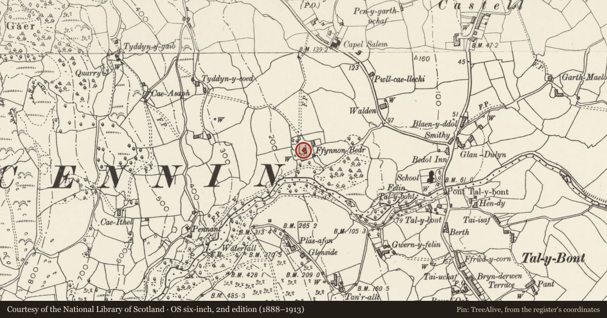
5 historical maps cover this location, the earliest the 1883 map "Watershed map England, Wales 3." (David Rumsey Map Collection, Stanford Libraries).
Historical maps covering this location
- 1883 · Watershed map England, Wales 3. (David Rumsey Map Collection, Stanford Libraries)
- 1896 · Sheet 7. Ordnance Survey of England and Wales. (David Rumsey Map Collection, Stanford Libraries)
- 1899 · 106 Bangor (Hills) (David Rumsey Map Collection, Stanford Libraries)
- 1899 · 106 Bangor (Outline) (David Rumsey Map Collection, Stanford Libraries)
- 1901 · Sheet 9 and 10. (David Rumsey Map Collection, Stanford Libraries)
Cadw's description
Location
Located immediately opposite Ffynnon Bedr Cottage to the W
History
Early site probably associated with the Medieval pilgrimage trade to the neighbouring St. Peter's well. Early foundations on the site reveal a large complex and the present stable and cart block abuts the foundations of a large building with massive boulder foundations to the N. The present building is early C19.
Exterior
Rectangular storied building of rubble with old slate roof. Large segmental cart entrance to E side with dressed voussoirs and an arc of narrow stones forming a label above. Entrance to R with cambered head and voussoirs as before; boarded door. 2 contemporary 2-light windows to the upper storey under the eaves; unglazed, with pegged oak frames and mullions. Loading bay with boarded door to R (N) gable; 2-bay collar truss roof.
Reason for designation
Included for group value with other listed items at Ffynnon Bedr.
Nearby in the register
- Barn at Ffynnon-BedrAgriculture and Subsistenceunder 1 mi
- Ffynnon-Bedr CottageDomesticunder 1 mi
- Tyddyn-y-Coed FarmhouseDomesticunder 1 mi
- Agricultural Range at Gwern FelinAgriculture and Subsistenceunder 1 mi
Other entries of the same register within about three miles of this one, by straight line.