Cof Cymru: National Historic Assets of Wales · Wales
Troedrhiwbeynon
Cilycwm, Carmarthenshire, Wales
A Grade II listed building in Cwm Gwenffrwd, Cilycwm, Carmarthenshire, designated on 29 November 1995.
The record
- Designation
- Listed building, Grade II
- Broad class
- Domestic
- Date of designation
- 29 November 1995
- Locality
- Cwm Gwenffrwd
- Community
- Cilycwm
- Unitary authority
- Carmarthenshire
- Country
- Wales
- Coordinates
- 52.09457, -3.82067
- Cadw reference
- 16994
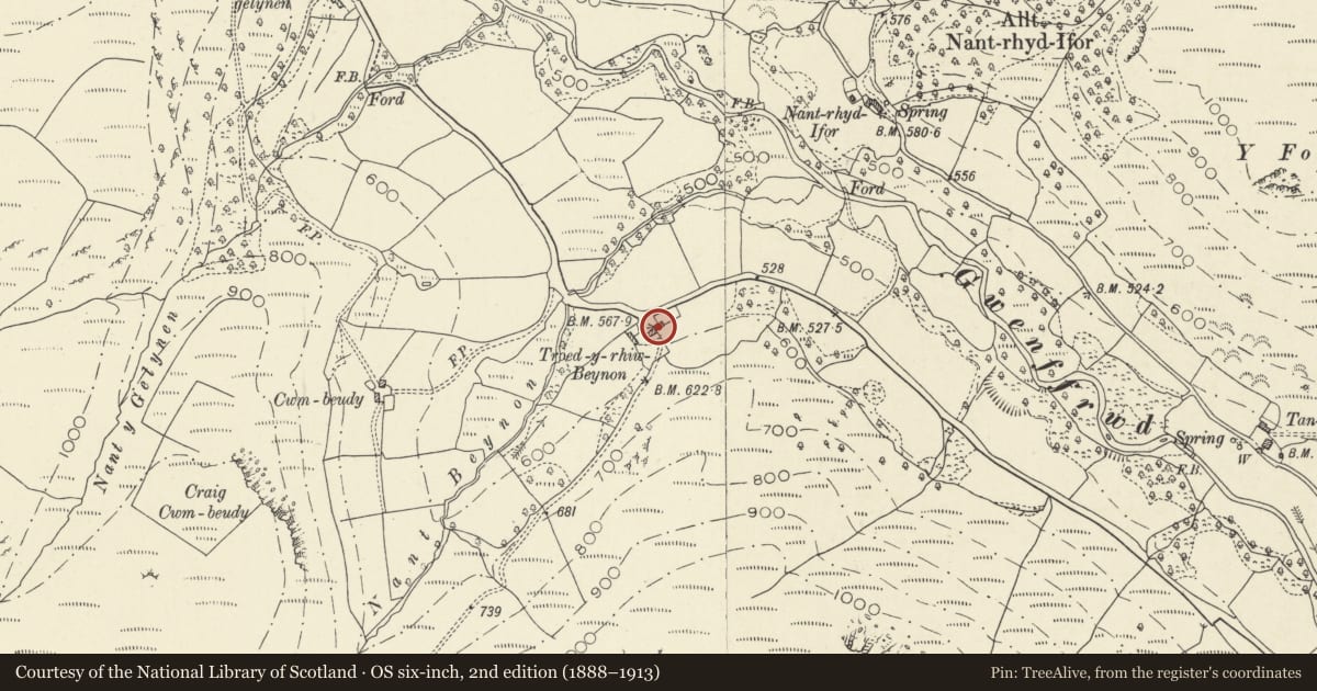
Slide toward Today to fade the historical sheet and see the modern map underneath.
David Rumsey Map Collection, Stanford LibrariesDavid Rumsey Map Collection, Stanford LibrariesDavid Rumsey Map Collection, Stanford LibrariesDavid Rumsey Map Collection, Stanford LibrariesDavid Rumsey Map Collection, Stanford Libraries
5 historical maps cover this location, the earliest the 1608 map "(13) Cambriae Typus." (David Rumsey Map Collection, Stanford Libraries).
Historical maps covering this location
- 1608 · (13) Cambriae Typus. (David Rumsey Map Collection, Stanford Libraries)
- 1637 · Particular description of Wales. Cambria seu Wallia (David Rumsey Map Collection, Stanford Libraries)
- 1830 · V.3:11-15:XV. Britisches Reich. A. Kon: England. b. Frstenthum Wales: Shire: 37-40 (David Rumsey Map Collection, Stanford Libraries)
- 1899 · 195 Lampeter (Hills) (David Rumsey Map Collection, Stanford Libraries)
- 1901 · Sheet 14. (David Rumsey Map Collection, Stanford Libraries)
Cadw's description
Location
Situated on S side of Gwenffrwd valley on road from Rhandirmwyn to Cwrtycadno, some 1.5 km NW of Rhandirmwyn Bridge.
History
Mid C19 farmhouse typical of steep upland valleys of northern part of Cilycwm C area. A house is marked on site on 1845 Tithe Map, owned by the Earl of Cawdor and occupied by David Jones, with 62 acres. This house could have been rebuilt slightly later.
Exterior
Rubble stone with slate roof, and roughcast end wall stacks. Two-storey, three-window N front, offset to right. Hornless 12-pane sashes with 4-panel door and margin-glazed overlight. Stone voussoirs. Rendered W end wall, rubble stone E end. Cowshed attached to W is whitewashed with slate roof, four doors and one window with cambered stone-voussoir heads.
Reason for designation
Included as a well preserved and representative example of the farmhouses of the small upland farms of this valley and the next valley to N.
Nearby in the register
- Cowshed at TroedrhiwbeynonAgriculture and Subsistenceunder 1 mi
- BroncwrtDomestic1 mi
- Rhandirmwyn Bridge (partly in Llanfair-ar-y-Bryn community)Transport1 mi
- Rhandirmwyn Bridge (partly in Cilycwm community)Transport1 mi
Other entries of the same register within about three miles of this one, by straight line.