Cof Cymru: National Historic Assets of Wales · Wales
Railway Bridge at Former Llechwedd Sidings
Ffestiniog, Gwynedd, Wales
A Grade II listed building in Llechwedd Slate Mine, Ffestiniog, Gwynedd, designated on 1 February 1996.
The record
- Designation
- Listed building, Grade II
- Broad class
- Transport
- Date of designation
- 1 February 1996
- Locality
- Llechwedd Slate Mine
- Community
- Ffestiniog
- Unitary authority
- Gwynedd
- Country
- Wales
- Coordinates
- 53.00328, -3.94334
- Cadw reference
- 16886
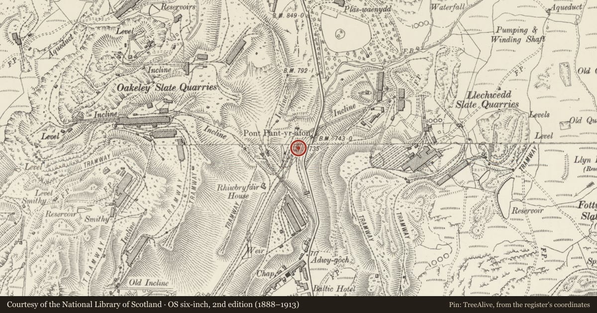
Slide toward Today to fade the historical sheet and see the modern map underneath.
David Rumsey Map Collection, Stanford LibrariesDavid Rumsey Map Collection, Stanford LibrariesDavid Rumsey Map Collection, Stanford LibrariesLlyfrgell Genedlaethol Cymru – The National Library of WalesDavid Rumsey Map Collection, Stanford Libraries
5 historical maps cover this location, the earliest the 1795 map "To Sir Watkin Williams-Wynn Bart ... the map of the six counties of North Wales is most humbly inscribed by his obedient humble servant" (Llyfrgell Genedlaethol Cymru – The National Library of Wales).
Historical maps covering this location
- 1795 · To Sir Watkin Williams-Wynn Bart ... the map of the six counties of North Wales is most… (Llyfrgell Genedlaethol Cymru – The National Library of Wales)
- 1883 · Watershed map England, Wales 3. (David Rumsey Map Collection, Stanford Libraries)
- 1896 · Sheet 7. Ordnance Survey of England and Wales. (David Rumsey Map Collection, Stanford Libraries)
- 1899 · 119 Snowdon (Hills) (David Rumsey Map Collection, Stanford Libraries)
- 1901 · Sheet 9 and 10. (David Rumsey Map Collection, Stanford Libraries)
Cadw's description
Location
Near the S entrance of Blaenau railway tunnel, immediately W of the road on the downhill approach to the town from the Crimea Pass.
Exterior
Description: Pair of cast-iron railway beam bridges, constructed 1879 when the Llechwedd slate mine established railway sidings to the E of the main railway track.. From here the slates were transported by rail to transhipment wharves at Deganwy. The bridges are heavily-rivetted and consist of 2 panels; the larger of the two spans the Afon Barlwydd at an angle and is approximately 6m long; that with the shallower beam spans a former tramway leading to a now disused incline. Originally carrying single tracks from the sidings to the main line, the rails have now been removed.
Listed as scarce examples of later C19 cast-iron beam bridges, and for group value with other listed items at the former Llechwedd sidings.
References: I. W. Jones, Llechwedd Slate Caverns, 1986, passim.
J.G. Isherwood, Slate From Blaenau Ffestiniog, 1988, 43.
Nearby in the register
- Hydro-Electric PowerstationIndustrialunder 1 mi
- Railway Bridge at Former Llechwedd SidingsTransportunder 1 mi
- Weighbridge HouseIndustrialunder 1 mi
- Crane at Former Llechwedd SidingsIndustrialunder 1 mi
Other entries of the same register within about three miles of this one, by straight line.