Cof Cymru: National Historic Assets of Wales · Wales
Hydro-Electric Powerstation
Ffestiniog, Gwynedd, Wales
A Grade II* listed building in Llechwedd Slate Mine, Ffestiniog, Gwynedd, designated on 1 February 1996.
The record
- Designation
- Listed building, Grade II*
- Broad class
- Industrial
- Date of designation
- 1 February 1996
- Locality
- Llechwedd Slate Mine
- Community
- Ffestiniog
- Unitary authority
- Gwynedd
- Country
- Wales
- Coordinates
- 53.00332, -3.94301
- Cadw reference
- 16884
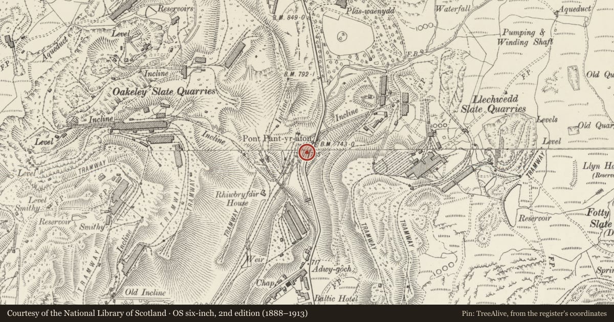
Slide toward Today to fade the historical sheet and see the modern map underneath.
David Rumsey Map Collection, Stanford LibrariesDavid Rumsey Map Collection, Stanford LibrariesDavid Rumsey Map Collection, Stanford LibrariesLlyfrgell Genedlaethol Cymru – The National Library of WalesDavid Rumsey Map Collection, Stanford Libraries
5 historical maps cover this location, the earliest the 1795 map "To Sir Watkin Williams-Wynn Bart ... the map of the six counties of North Wales is most humbly inscribed by his obedient humble servant" (Llyfrgell Genedlaethol Cymru – The National Library of Wales).
Historical maps covering this location
- 1795 · To Sir Watkin Williams-Wynn Bart ... the map of the six counties of North Wales is most… (Llyfrgell Genedlaethol Cymru – The National Library of Wales)
- 1883 · Watershed map England, Wales 3. (David Rumsey Map Collection, Stanford Libraries)
- 1896 · Sheet 7. Ordnance Survey of England and Wales. (David Rumsey Map Collection, Stanford Libraries)
- 1899 · 119 Snowdon (Hills) (David Rumsey Map Collection, Stanford Libraries)
- 1901 · Sheet 9 and 10. (David Rumsey Map Collection, Stanford Libraries)
Cadw's description
Location
Located immediately to the W of the main road on an island between it and the main railway line, on the downhill approach to Blaenau Ffestiniog from the Crimea Pass.
History
The underground quarry at Llechwedd was opened in 1846 by J.W. Greaves and by the end of the century had become one of the largest and most successful in the area; in 1882 the quarry employed 553 men and had an output of 25,118 tonnes (24,723 tons), a record at the time. The quarry switched from steam to electric power c1906 and the power station was contructed at this time soley to serve Llechwood. The water is piped down from reservoirs on the Moel Bowydd; the station is still in use.
Exterior
Single-storey building of slate with slate roof; half-hipped gables and deep verges and eaves. 4 large small-paned wooden cross-windows on the long railway-facing side. Single-storey entrance porch with boarded door and half-hipped slated roof; weather-coursing at intersection with main block.
Interior
This remains almost entirely unaltered since its construction with the original twin system of turbines and generators still in use. Turbines by Gilbert Gilkes and Co of Kendal, operating 175kw DC Johnson and Philips generators at 385 RPM. General Electric switch gear with meters by Lionel Robinson and Co. of Thames Ditton. 8-bay roof with plain bolted king-post trusses; contemporary 5 ton gantry crane.
Reason for designation
Listed Grade II* as an exceptionally important, still operational example of an early hydro-electrical power station.
Group value with neighbouring listed items at Llecwedd.
Nearby in the register
- Railway Bridge at Former Llechwedd SidingsTransportunder 1 mi
- Weighbridge HouseIndustrialunder 1 mi
- Railway Bridge at Former Llechwedd SidingsTransportunder 1 mi
- Crane at Former Llechwedd SidingsIndustrialunder 1 mi
Other entries of the same register within about three miles of this one, by straight line.