Cof Cymru: National Historic Assets of Wales · Wales
Former Lloyd's Bank Premises
Overton, Wrexham, Wales
A Grade II listed building in Overton, Wrexham, designated on 16 November 1962.
The record
- Designation
- Listed building, Grade II
- Broad class
- Domestic
- Date of designation
- 16 November 1962
- Community
- Overton
- Unitary authority
- Wrexham
- Country
- Wales
- Coordinates
- 52.96904, -2.93464
- Cadw reference
- 1687
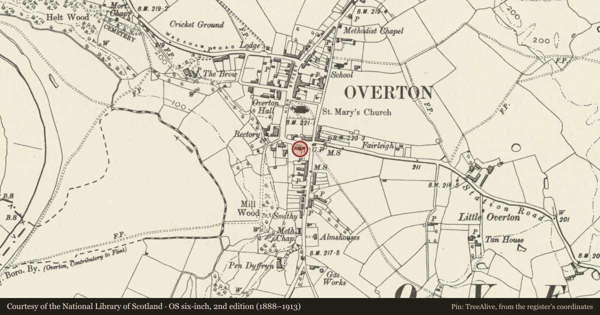
Slide toward Today to fade the historical sheet and see the modern map underneath.
David Rumsey Map Collection, Stanford LibrariesDavid Rumsey Map Collection, Stanford LibrariesDavid Rumsey Map Collection, Stanford LibrariesDavid Rumsey Map Collection, Stanford LibrariesDavid Rumsey Map Collection, Stanford Libraries
5 historical maps cover this location, the earliest the 1608 map "(13) Cambriae Typus." (David Rumsey Map Collection, Stanford Libraries).
Historical maps covering this location
- 1608 · (13) Cambriae Typus. (David Rumsey Map Collection, Stanford Libraries)
- 1637 · Particular description of Wales. Cambria seu Wallia (David Rumsey Map Collection, Stanford Libraries)
- 1830 · V.3:11-15:XV.Britisches Reich. A. Kon: England. a. England ab sich: Shire:15-17, 33 (David Rumsey Map Collection, Stanford Libraries)
- 1883 · Watershed map England, Wales 3. (David Rumsey Map Collection, Stanford Libraries)
- 1901 · Sheet 9 and 10. (David Rumsey Map Collection, Stanford Libraries)
Cadw's description
Location
Towards the junction of Pen-y-Llan Street and Salop Road, adjoining the former Cocoa Rooms.
Exterior
Small house, probably largely late C18, but traces of timber framing in rear elevation suggest that it is the remodelling of an earlier structure. Painted brick with tiled roof. Two-storeys, 2 unit plan with central entrance in trellised porch flanked by flush framed sash windows. Plat band below first floor. End wall stacks.
Reason for designation
A typical example of a late C18 small house, of added interest for its apparent earlier origins.
Nearby in the register
- 2nd outbuilding to Gwydyr HouseDomesticunder 1 mi
- 1st Outbuilding to Gwydyr HouseDomesticunder 1 mi
- Gwydyr House (former RS & P Garden Machinery Specialists)Domesticunder 1 mi
- Wall with two former OutbuildingsDomesticunder 1 mi
Other entries of the same register within about three miles of this one, by straight line.