Cof Cymru: National Historic Assets of Wales · Wales
Wall with two former Outbuildings
Overton, Wrexham, Wales
A Grade II listed building in Overton, Wrexham, designated on 15 March 1994.
The record
- Designation
- Listed building, Grade II
- Broad class
- Domestic
- Date of designation
- 15 March 1994
- Locality
- Overton
- Community
- Overton
- Unitary authority
- Wrexham
- Country
- Wales
- Coordinates
- 52.96933, -2.93532
- Cadw reference
- 14444
Slide toward Today to fade the historical sheet and see the modern map underneath.
David Rumsey Map Collection, Stanford LibrariesDavid Rumsey Map Collection, Stanford LibrariesDavid Rumsey Map Collection, Stanford LibrariesDavid Rumsey Map Collection, Stanford LibrariesDavid Rumsey Map Collection, Stanford Libraries
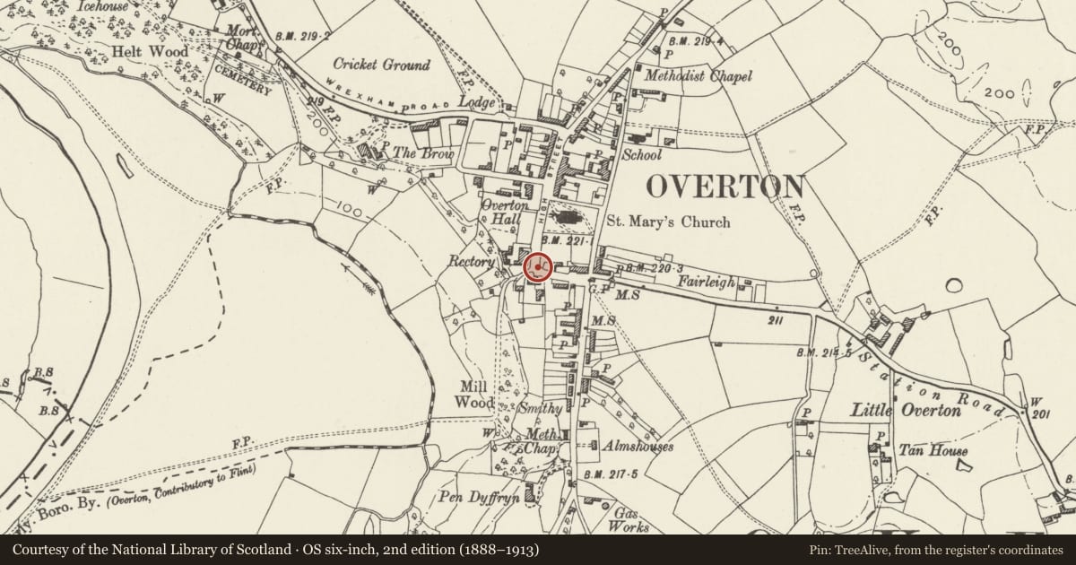
5 historical maps cover this location, the earliest the 1608 map "(13) Cambriae Typus." (David Rumsey Map Collection, Stanford Libraries).
Historical maps covering this location
- 1608 · (13) Cambriae Typus. (David Rumsey Map Collection, Stanford Libraries)
- 1637 · Particular description of Wales. Cambria seu Wallia (David Rumsey Map Collection, Stanford Libraries)
- 1830 · V.3:11-15:XV.Britisches Reich. A. Kon: England. a. England ab sich: Shire:15-17, 33 (David Rumsey Map Collection, Stanford Libraries)
- 1883 · Watershed map England, Wales 3. (David Rumsey Map Collection, Stanford Libraries)
- 1901 · Sheet 9 and 10. (David Rumsey Map Collection, Stanford Libraries)
Cadw's description
Location
Abuts the pavement at the corner of Pen-y-llan Street and High Street.
History
C19 boundary wall with 2 former outbuildings, perhaps originally stabling to the adjacent Gwydyr House, but now both in use as shops/offices.
Exterior
The wall is brick with 2 distinctive bands of headers, and divided by pilasters with moulded caps and raking finials. Curved brick plinth above dentilled cornice. The 2 buildings are symmetrically planned and appear to be integrally built with the wall: they are single storeyed, with gables facing the street. Both are also brick (the gable wall rendered in the butcher’s shop to the left) with red plain tiled roofs, and have elaborate treatment of the gables, with moulded kneelers to copings, and squat finial at apex: these details echo those on Gwydyr House, suggesting that they were built to serve it. Openings are largely renewed, but an oculus survives in the apex of the right hand building.
Reason for designation
Listed for group value.
Nearby in the register
- Pen-y-Llan HouseCommercialunder 1 mi
- 1st Outbuilding to Gwydyr HouseDomesticunder 1 mi
- Bryn-y-Pys Estate OfficeDomesticunder 1 mi
- Saint Mary's HouseDomesticunder 1 mi
Other entries of the same register within about three miles of this one, by straight line.