Cof Cymru: National Historic Assets of Wales · Wales
Nant-y-caws
Welshpool, Powys, Wales
A Grade II listed building in Talyrnau, Welshpool, Powys, designated on 29 February 1996.
The record
- Designation
- Listed building, Grade II
- Broad class
- Domestic
- Date of designation
- 29 February 1996
- Locality
- Talyrnau
- Community
- Welshpool
- Unitary authority
- Powys
- Country
- Wales
- Coordinates
- 52.65341, -3.17934
- Cadw reference
- 16812
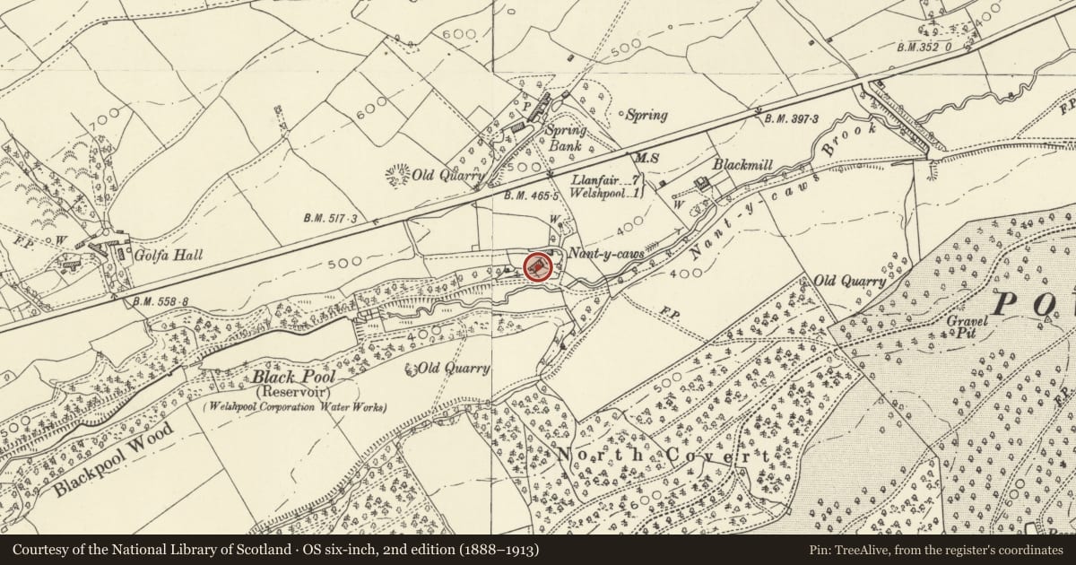
Slide toward Today to fade the historical sheet and see the modern map underneath.
David Rumsey Map Collection, Stanford LibrariesDavid Rumsey Map Collection, Stanford LibrariesDavid Rumsey Map Collection, Stanford LibrariesDavid Rumsey Map Collection, Stanford LibrariesLlyfrgell Genedlaethol Cymru – The National Library of Wales
5 historical maps cover this location, the earliest the 1795 map "To Sir Watkin Williams-Wynn Bart ... the map of the six counties of North Wales is most humbly inscribed by his obedient humble servant" (Llyfrgell Genedlaethol Cymru – The National Library of Wales).
Historical maps covering this location
- 1795 · To Sir Watkin Williams-Wynn Bart ... the map of the six counties of North Wales is most… (Llyfrgell Genedlaethol Cymru – The National Library of Wales)
- 1883 · Watershed map England, Wales 3. (David Rumsey Map Collection, Stanford Libraries)
- 1899 · 151 Welshpool (Hills) (David Rumsey Map Collection, Stanford Libraries)
- 1901 · Sheet 9 and 10. (David Rumsey Map Collection, Stanford Libraries)
- 1916 · Sheet 60. Shrewsbury. (David Rumsey Map Collection, Stanford Libraries)
Cadw's description
Location
750m approx. SW of the roundabout to the W of Welshpool, above the brook on the lower side of the A458 Dolgellau Road; approached via the lane leading
Exterior
History: The building forms a pair of estate cottages for the Powis Estate; the layout and detailing suggests an early C19 date, but this may represent the remodelling of an earlier building: the constructional detailing (which includes some structural timberwork), suggests a C18 origin.
Exterior: A symmetrical pair of cottages; timber-framed, with brick infil, the brickwork painted in imitation of timber- framing, and enriched with quatrefoil decoration; rubble in side elevations. Slate roofs. 2 storeys, 2-window central range, running between slightly advanced outer gabled wings. Doorways in the re-entrant angle of each wing...
Listed as a pair of Picturesque estate cottages, which may also have earlier vernacular origins.
Nearby in the register
- Spring BankDomesticunder 1 mi
- Llanerchydol HallDomesticunder 1 mi
- Golfa HallDomesticunder 1 mi
- Llanerchydol Hall Stable Block including entrance to courtyardDomesticunder 1 mi
Other entries of the same register within about three miles of this one, by straight line.