Cof Cymru: National Historic Assets of Wales · Wales
41 Salop Road
Welshpool, Powys, Wales
A Grade II listed building in Welshpool, Powys, designated on 11 March 1981.
The record
- Designation
- Listed building, Grade II
- Broad class
- Domestic
- Date of designation
- 11 March 1981
- Locality
- Welshpool
- Community
- Welshpool
- Unitary authority
- Powys
- Country
- Wales
- Coordinates
- 52.66100, -3.14422
- Cadw reference
- 16723
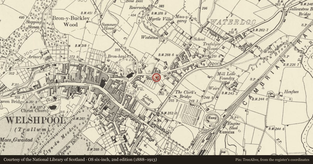
Slide toward Today to fade the historical sheet and see the modern map underneath.
David Rumsey Map Collection, Stanford LibrariesDavid Rumsey Map Collection, Stanford LibrariesDavid Rumsey Map Collection, Stanford LibrariesDavid Rumsey Map Collection, Stanford LibrariesLlyfrgell Genedlaethol Cymru – The National Library of Wales
5 historical maps cover this location, the earliest the 1795 map "To Sir Watkin Williams-Wynn Bart ... the map of the six counties of North Wales is most humbly inscribed by his obedient humble servant" (Llyfrgell Genedlaethol Cymru – The National Library of Wales).
Historical maps covering this location
- 1795 · To Sir Watkin Williams-Wynn Bart ... the map of the six counties of North Wales is most… (Llyfrgell Genedlaethol Cymru – The National Library of Wales)
- 1883 · Watershed map England, Wales 3. (David Rumsey Map Collection, Stanford Libraries)
- 1899 · 151 Welshpool (Hills) (David Rumsey Map Collection, Stanford Libraries)
- 1901 · Sheet 9 and 10. (David Rumsey Map Collection, Stanford Libraries)
- 1916 · Sheet 60. Shrewsbury. (David Rumsey Map Collection, Stanford Libraries)
Cadw's description
Location
To the E of the junction with Mill Lane.
Exterior
Built as a terrace of 4 houses c1820. Brick fronted, with local roughly coursed and squared rubble to rear. Slate roof with end wall and axial stacks. 3 storeys, comprises a central 4-window range (Nos 39 and 40), with a separately roofed 3-window range to the left (No 38), and a hipped roofed block slightly advanced to the right (No 41), but similar detail throughout. No 38 has central entrance, a 6-panelled door with panelled rebates flanked by late C19 canted bay windows, linked by a continuous pentice roof, carried on chamfered posts to either side of the doorway. 12-pane sash windows above (blind painted over the doorway), and 6-paned in attic storey. Paired entrances to Nos 39-40, (4-panelled door to No 39, part glazed panelled door to No 40), with elliptical heads and traceried fanlights, and similar doorway to left in No 41. Flanking windows are 12-pane sashes with flat arched gauged brick heads. Upper windows throughout are similar, with 6-panes in attic storey. A continuous painted sill band runs across the terrace below the first floor windows. Inscribed stone tablet on No 41, 'Terrace Buildings'. Stone rear elevations have voussoir headed windows, including round-arched tall stair windows.
A fine early C19 urban terrace, built on an ambitious scale, and preserving much of its original high quality detailing.
Nearby in the register
- 40 Salop RoadDomesticunder 1 mi
- 39 Salop RoadDomesticunder 1 mi
- Railings to front gardensGardens, Parks and Urban Spacesunder 1 mi
- 38 Salop RoadDomesticunder 1 mi
Other entries of the same register within about three miles of this one, by straight line.