Cof Cymru: National Historic Assets of Wales · Wales
Gatepiers and Gates at Church of St Peter
Llanbedr Dyffryn Clwyd, Denbighshire, Wales
A Grade II listed building in Llanbedr Dyffryn Clwyd, Denbighshire, designated on 21 December 1995.
The record
- Designation
- Listed building, Grade II
- Broad class
- Religious, Ritual and Funerary
- Date of designation
- 21 December 1995
- Locality
- Llanbedr Dyffryn Clwyd
- Community
- Llanbedr Dyffryn Clwyd
- Unitary authority
- Denbighshire
- Country
- Wales
- Coordinates
- 53.12445, -3.28043
- Cadw reference
- 16595
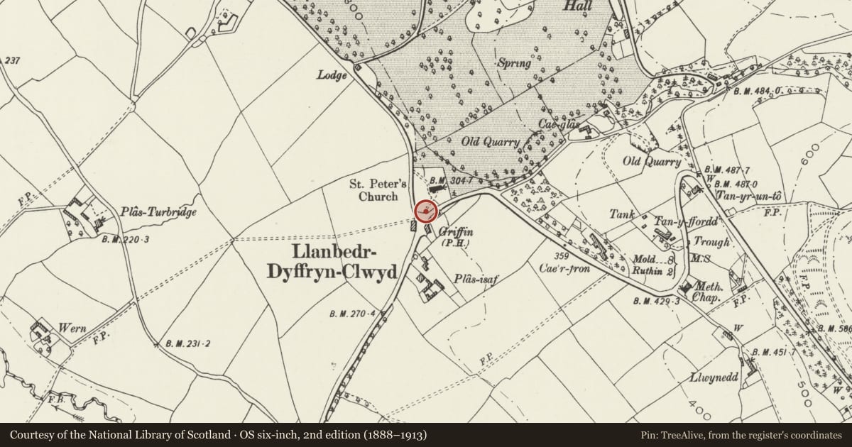
Slide toward Today to fade the historical sheet and see the modern map underneath.
David Rumsey Map Collection, Stanford LibrariesDavid Rumsey Map Collection, Stanford LibrariesDavid Rumsey Map Collection, Stanford LibrariesLlyfrgell Genedlaethol Cymru – The National Library of WalesDavid Rumsey Map Collection, Stanford Libraries
5 historical maps cover this location, the earliest the 1795 map "To Sir Watkin Williams-Wynn Bart ... the map of the six counties of North Wales is most humbly inscribed by his obedient humble servant" (Llyfrgell Genedlaethol Cymru – The National Library of Wales).
Historical maps covering this location
- 1795 · To Sir Watkin Williams-Wynn Bart ... the map of the six counties of North Wales is most… (Llyfrgell Genedlaethol Cymru – The National Library of Wales)
- 1883 · Watershed map England, Wales 3. (David Rumsey Map Collection, Stanford Libraries)
- 1898 · 108 Flint (Hills) (David Rumsey Map Collection, Stanford Libraries)
- 1898 · 108 Flint (Outline) (David Rumsey Map Collection, Stanford Libraries)
- 1901 · Sheet 9 and 10. (David Rumsey Map Collection, Stanford Libraries)
Cadw's description
Location
Located at the SW entrance to the churchyard.
History
Contemporary with church (1863), and no doubt also by Poundley & Walker, architects; the piers mirror the buttressing on the church.
Exterior
Two pairs of gatepiers with single gates flanking a pair of central double gates. Grey rock-faced stone piers, approximately 2.1m high, with smooth gabled copings. These have roundels to front and rear, crocketed finials, and taper in half-hipped arrangement; slightly battered bases. Main gates of wrought-iron with horizontal panels of scrolls and vertical bars, with fleurs-de-lis finials; similar single gates to ends.
The end gatepiers connect with the rubble walls of the churchyard.
Reason for designation
Listed as a fine set of piers and gates which are an integrally-designed part of the setting of the church.
Group value with St Peter's Church.
Nearby in the register
- The GatehouseDomesticunder 1 mi
- The Griffin Public HouseCommercialunder 1 mi
- Lloyd Monument at Church of St PeterCommemorativeunder 1 mi
- Church of St PeterReligious, Ritual and Funeraryunder 1 mi
Other entries of the same register within about three miles of this one, by straight line.