Cof Cymru: National Historic Assets of Wales · Wales
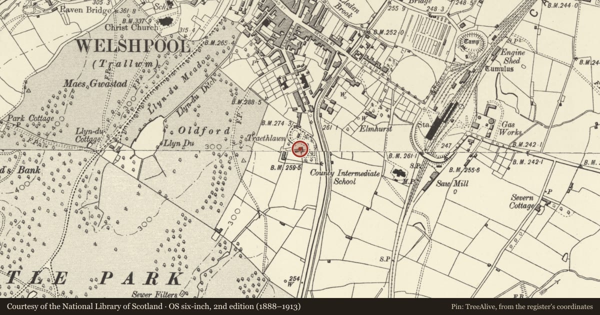
Traethllawn
Welshpool, Powys, Wales
A Grade II listed building in Welshpool, Powys, designated on 29 February 1996.
The record
- Designation
- Listed building, Grade II
- Broad class
- Domestic
- Date of designation
- 29 February 1996
- Locality
- Welshpool
- Community
- Welshpool
- Unitary authority
- Powys
- Country
- Wales
- Coordinates
- 52.65618, -3.14699
- Cadw reference
- 16579
Slide toward Today to fade the historical sheet and see the modern map underneath.
David Rumsey Map Collection, Stanford LibrariesDavid Rumsey Map Collection, Stanford LibrariesDavid Rumsey Map Collection, Stanford LibrariesDavid Rumsey Map Collection, Stanford LibrariesLlyfrgell Genedlaethol Cymru – The National Library of Wales
5 historical maps cover this location, the earliest the 1795 map "To Sir Watkin Williams-Wynn Bart ... the map of the six counties of North Wales is most humbly inscribed by his obedient humble servant" (Llyfrgell Genedlaethol Cymru – The National Library of Wales).
Historical maps covering this location
- 1795 · To Sir Watkin Williams-Wynn Bart ... the map of the six counties of North Wales is most… (Llyfrgell Genedlaethol Cymru – The National Library of Wales)
- 1883 · Watershed map England, Wales 3. (David Rumsey Map Collection, Stanford Libraries)
- 1899 · 151 Welshpool (Hills) (David Rumsey Map Collection, Stanford Libraries)
- 1901 · Sheet 9 and 10. (David Rumsey Map Collection, Stanford Libraries)
- 1916 · Sheet 60. Shrewsbury. (David Rumsey Map Collection, Stanford Libraries)
Cadw's description
Location
Set back from the road in gardens on the S side of Oldford Rise.
Exterior
History: The house was built on land belonging to the Powis Estate some time between 1850 and 1854.
Description: Coursed and squared local granite rubble with tooled dressings, including quoins at angles and to window surrounds. Slate roof, deeply overhanging on modillion eaves brackets; paired stacks in each gable with moulded caps. 2 storeys, 3-window range symmetrically planned with central entrance in slightly advanced pedimented gable. Double pile plan and short rear wing of less height. Paired partly glazed door with overlight in stone architrave with cornice and blocking course. Windows throughout (including the N gable return) are sashes with marginal glazing of unusual design.
The house is a distinctive mid C19 building retaining much of its original character.
References: Information from owner;
'General Plan of the District of Welchpool Prepared for the Purposes of the Public Health Act', 1854, National Library of Wales.
Nearby in the register
- Former Grammar SchoolInstitutionalunder 1 mi
- Oldford HouseDomesticunder 1 mi
- ElmhurstDomesticunder 1 mi
- Dolanog CottagesDomesticunder 1 mi
Other entries of the same register within about three miles of this one, by straight line.