Cof Cymru: National Historic Assets of Wales · Wales
Elmhurst
Welshpool, Powys, Wales
A Grade II listed building in Welshpool, Powys, designated on 29 February 1996.
The record
- Designation
- Listed building, Grade II
- Broad class
- Domestic
- Date of designation
- 29 February 1996
- Locality
- Welshpool
- Community
- Welshpool
- Unitary authority
- Powys
- Country
- Wales
- Coordinates
- 52.65706, -3.14390
- Cadw reference
- 16726
Slide toward Today to fade the historical sheet and see the modern map underneath.
David Rumsey Map Collection, Stanford LibrariesDavid Rumsey Map Collection, Stanford LibrariesDavid Rumsey Map Collection, Stanford LibrariesDavid Rumsey Map Collection, Stanford LibrariesLlyfrgell Genedlaethol Cymru – The National Library of Wales
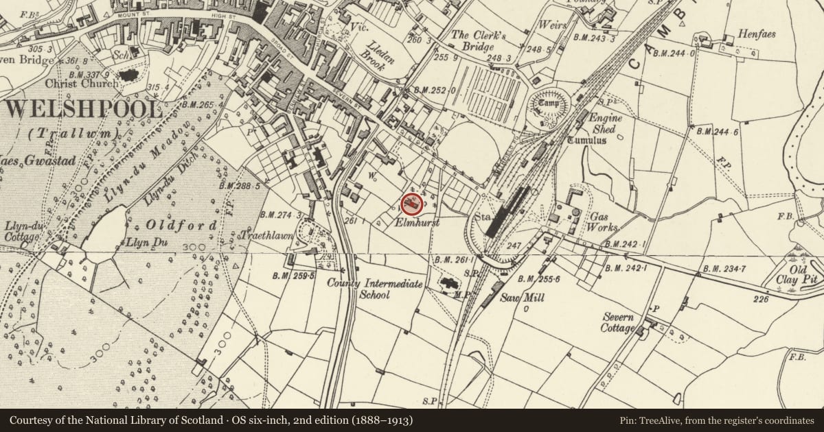
5 historical maps cover this location, the earliest the 1795 map "To Sir Watkin Williams-Wynn Bart ... the map of the six counties of North Wales is most humbly inscribed by his obedient humble servant" (Llyfrgell Genedlaethol Cymru – The National Library of Wales).
Historical maps covering this location
- 1795 · To Sir Watkin Williams-Wynn Bart ... the map of the six counties of North Wales is most… (Llyfrgell Genedlaethol Cymru – The National Library of Wales)
- 1883 · Watershed map England, Wales 3. (David Rumsey Map Collection, Stanford Libraries)
- 1899 · 151 Welshpool (Hills) (David Rumsey Map Collection, Stanford Libraries)
- 1901 · Sheet 9 and 10. (David Rumsey Map Collection, Stanford Libraries)
- 1916 · Sheet 60. Shrewsbury. (David Rumsey Map Collection, Stanford Libraries)
Cadw's description
Location
Set back from the road in grounds on the W side of the Police Station.
Exterior
History: The house was built for Miss Clive, sister to Archdeacon Clive, and niece of Robert, Lord Clive, c1840.
Exterior: Simple domestic gothic style. Random local sandstone rubble with painted freestone dressings and slate roof with coped gables and axial and gable end stacks. 2 storeys, 3-window range with secondary advanced wing to the right. Advanced central gable houses entrance in embattled and buttressed shallow porch with depressed 4-centred arch and paired partly glazed inner doors. 3-light mullioned and transomed window with small panes above the entrance. Flanking bays have tall 2-light mullioned and transomed windows with small panes on each floor. Similar fenestration in gable end of advanced right hand wing.
A fine example of the domestic gothic style favoured for larger houses in the mid C1
Nearby in the register
- Dolanog CottagesDomesticunder 1 mi
- Gates, gate piers & boundary walls to Nos 1-4 Clive PlaceDomesticunder 1 mi
- Clive PlaceDomesticunder 1 mi
- Clive PlaceDomesticunder 1 mi
Other entries of the same register within about three miles of this one, by straight line.