Cof Cymru: National Historic Assets of Wales · Wales
Henblas
Gwersyllt, Wrexham, Wales
A Grade II listed building in Little Mountain, Gwersyllt, Wrexham, designated on 1 December 1995.
The record
- Designation
- Listed building, Grade II
- Broad class
- Domestic
- Date of designation
- 1 December 1995
- Locality
- Little Mountain
- Community
- Gwersyllt
- Unitary authority
- Wrexham
- Country
- Wales
- Coordinates
- 53.06531, -3.02464
- Cadw reference
- 16536
Slide toward Today to fade the historical sheet and see the modern map underneath.
David Rumsey Map Collection, Stanford LibrariesDavid Rumsey Map Collection, Stanford LibrariesDavid Rumsey Map Collection, Stanford LibrariesLlyfrgell Genedlaethol Cymru – The National Library of WalesDavid Rumsey Map Collection, Stanford Libraries
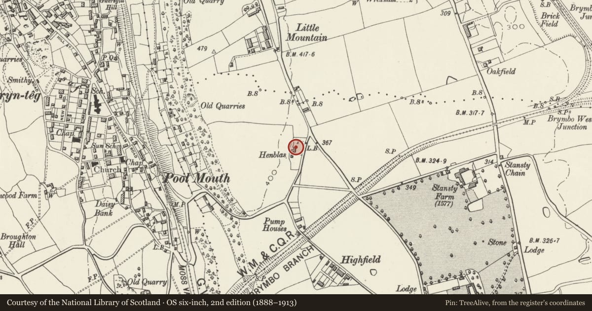
5 historical maps cover this location, the earliest the 1608 map "(13) Cambriae Typus." (David Rumsey Map Collection, Stanford Libraries).
Historical maps covering this location
- 1608 · (13) Cambriae Typus. (David Rumsey Map Collection, Stanford Libraries)
- 1795 · To Sir Watkin Williams-Wynn Bart ... the map of the six counties of North Wales is most… (Llyfrgell Genedlaethol Cymru – The National Library of Wales)
- 1883 · Watershed map England, Wales 3. (David Rumsey Map Collection, Stanford Libraries)
- 1898 · 121 Wrexham (Hills) (David Rumsey Map Collection, Stanford Libraries)
- 1901 · Sheet 9 and 10. (David Rumsey Map Collection, Stanford Libraries)
Cadw's description
Location
South of Little Mountain, on the W side of a lane leading SW from Summerhill Road to Moss Valley Park.
History
The house is dated 1694, but was re-worked c1900.
Exterior
Line-out render over brick, with old graded slate roof. Projecting end wall stacks and coped gables. 2 storeys with attic, 3-window range with central entrance. 6-panelled door (partially glazed) in moulded architrave with panelled rebates and scrolled brackets carrying entablature. Date painted onto entablature taken recently from the original datestone in a chimney. Flanking ground floor windows are wood mullioned and transomed floor-length casements; upper windows are 16-pane hornless sashes. Single gabled dormer window to attic. Fretted bargeboards.
Interior
Plan comprises central entrance hall with stairs offset to rear, and principal rooms to either side. Internal detail appears to be largely c1900, but the deep moulded plaster cornices (including panelled beams) may represent earlier work.
Reason for designation
A good example of a small late C17 polite house, a building type rare in this area.
Nearby in the register
- Bridge over Former RailwayTransportunder 1 mi
- Stansty Park with attached Garden GatewayDomesticunder 1 mi
- Church of St PeterReligious, Ritual and Funeraryunder 1 mi
- War Memorial with Railings to Memorial GardensCommemorativeunder 1 mi
Other entries of the same register within about three miles of this one, by straight line.