Cof Cymru: National Historic Assets of Wales · Wales
Hay Barn at Colomendy Hall
Llanferres, Denbighshire, Wales
A Grade II listed building in Loggerheads, Llanferres, Denbighshire, designated on 16 October 1995.
The record
- Designation
- Listed building, Grade II
- Broad class
- Agriculture and Subsistence
- Date of designation
- 16 October 1995
- Locality
- Loggerheads
- Community
- Llanferres
- Unitary authority
- Denbighshire
- Country
- Wales
- Coordinates
- 53.15351, -3.19789
- Cadw reference
- 16445
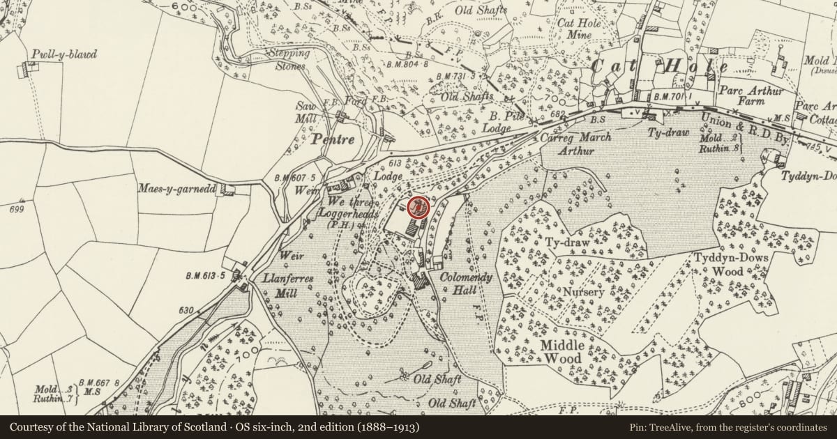
Slide toward Today to fade the historical sheet and see the modern map underneath.
David Rumsey Map Collection, Stanford LibrariesDavid Rumsey Map Collection, Stanford LibrariesDavid Rumsey Map Collection, Stanford LibrariesDavid Rumsey Map Collection, Stanford LibrariesLlyfrgell Genedlaethol Cymru – The National Library of Wales
5 historical maps cover this location, the earliest the 1795 map "To Sir Watkin Williams-Wynn Bart ... the map of the six counties of North Wales is most humbly inscribed by his obedient humble servant" (Llyfrgell Genedlaethol Cymru – The National Library of Wales).
Historical maps covering this location
- 1795 · To Sir Watkin Williams-Wynn Bart ... the map of the six counties of North Wales is most… (Llyfrgell Genedlaethol Cymru – The National Library of Wales)
- 1883 · Watershed map England, Wales 3. (David Rumsey Map Collection, Stanford Libraries)
- 1898 · 108 Flint (Hills) (David Rumsey Map Collection, Stanford Libraries)
- 1898 · 108 Flint (Outline) (David Rumsey Map Collection, Stanford Libraries)
- 1901 · Sheet 9 and 10. (David Rumsey Map Collection, Stanford Libraries)
Cadw's description
Location
Situated to the N of Colomendy Hall immediately N of the farmyard reached from a drive which runs S off the A494 beside the Three Loggerheads PH.
History
Built on the foundations of an earlier, probably early C19 structure, the barn probably dates from a phase of later C19 estate improvements.
Exterior
Rubble, brick piers, slate roof. 5 bays with tall well-finished brick piers rising from linked stone piers relating to an earlier structure. A further range of similar construction with a simple rubble base is set at right angles at the left hand end with the first 2 bays projecting forward to give a T-shaped plan.
Interior
The roof has scissor braced trusses in a style common to other Colomendy Estate buildings of this date.
Reason for designation
Listed as an unusual and well preserved example of an estate hay barn, and for its associations with the Colomendy Estate.
Nearby in the register
- Colomendy HallDomesticunder 1 mi
- Pentre Mill (including Sluice and Cast Iron Flume to rear)Industrialunder 1 mi
- Ty'n y FedwDomesticunder 1 mi
- Aberduna Engine HouseIndustrialunder 1 mi
Other entries of the same register within about three miles of this one, by straight line.