Cof Cymru: National Historic Assets of Wales · Wales
Aberduna Engine House
Llanferres, Denbighshire, Wales
A Grade II listed building in Aberduna, Llanferres, Denbighshire, designated on 20 September 1990.
The record
- Designation
- Listed building, Grade II
- Broad class
- Industrial
- Date of designation
- 20 September 1990
- Locality
- Aberduna
- Community
- Llanferres
- Unitary authority
- Denbighshire
- Country
- Wales
- Coordinates
- 53.14764, -3.18885
- Cadw reference
- 1342
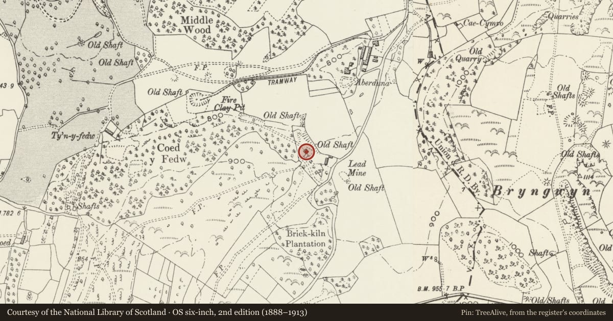
Slide toward Today to fade the historical sheet and see the modern map underneath.
David Rumsey Map Collection, Stanford LibrariesDavid Rumsey Map Collection, Stanford LibrariesDavid Rumsey Map Collection, Stanford LibrariesDavid Rumsey Map Collection, Stanford LibrariesLlyfrgell Genedlaethol Cymru – The National Library of Wales
5 historical maps cover this location, the earliest the 1795 map "To Sir Watkin Williams-Wynn Bart ... the map of the six counties of North Wales is most humbly inscribed by his obedient humble servant" (Llyfrgell Genedlaethol Cymru – The National Library of Wales).
Historical maps covering this location
- 1795 · To Sir Watkin Williams-Wynn Bart ... the map of the six counties of North Wales is most… (Llyfrgell Genedlaethol Cymru – The National Library of Wales)
- 1883 · Watershed map England, Wales 3. (David Rumsey Map Collection, Stanford Libraries)
- 1898 · 108 Flint (Hills) (David Rumsey Map Collection, Stanford Libraries)
- 1898 · 108 Flint (Outline) (David Rumsey Map Collection, Stanford Libraries)
- 1901 · Sheet 9 and 10. (David Rumsey Map Collection, Stanford Libraries)
Cadw's description
Location
Situated in the edge of woodland NE of Aberduna Quarry. Reached by a footpath running W from the by road between Maeshafn and Gwernymynydd.
History
Built pre-1870 to house a pumping engine for the local lead mines.
Exterior
Roofless rubble walls, 3-storey Cornish engine house. Large squared quoins to slightly battered corners. Some brick dressings; pitched gables without cappings. Large openings on 3 levels to NW gable, all with timber lintels. Smaller openings with timber lintels and sills high up on side walls. Large ground level openings, partially blocked, in SE gable, small camber-headed blocked doorway to SW wall.
Interior
Not fully accessible, contains decaying timber joists and beam seatings.
Reason for designation
Listed as a good surviving example of an engine house and for associations with the local lead mining industry.
Nearby in the register
- Ty'n y FedwDomesticunder 1 mi
- Colomendy HallDomesticunder 1 mi
- Hay Barn at Colomendy HallAgriculture and Subsistenceunder 1 mi
- Telephone Call-box to N of Miner's Arms PHNo class recordedunder 1 mi
Other entries of the same register within about three miles of this one, by straight line.