Cof Cymru: National Historic Assets of Wales · Wales
The Rectory
Llanfair, Vale of Glamorgan, Wales
A Grade II listed building in Llandough, Llanfair, Vale of Glamorgan, designated on 22 September 1995.
The record
- Designation
- Listed building, Grade II
- Broad class
- Domestic
- Date of designation
- 22 September 1995
- Locality
- Llandough
- Community
- Llanfair
- Unitary authority
- Vale of Glamorgan
- Country
- Wales
- Coordinates
- 51.44285, -3.44545
- Cadw reference
- 16415
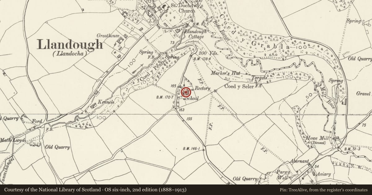
Slide toward Today to fade the historical sheet and see the modern map underneath.
David Rumsey Map Collection, Stanford LibrariesDavid Rumsey Map Collection, Stanford LibrariesDavid Rumsey Map Collection, Stanford LibrariesDavid Rumsey Map Collection, Stanford LibrariesDavid Rumsey Map Collection, Stanford Libraries
5 historical maps cover this location, the earliest the 1636 map "Cornubia : Devonia, Somersetus, Dorcestria, Wiltonia, Glocestria ..." (David Rumsey Map Collection, Stanford Libraries).
Historical maps covering this location
- 1636 · Cornubia : Devonia, Somersetus, Dorcestria, Wiltonia, Glocestria ... (David Rumsey Map Collection, Stanford Libraries)
- 1637 · The fourth table of England. Cornub. Devonia, Somerset etc. (David Rumsey Map Collection, Stanford Libraries)
- 1865 · England and Wales. England No. 6. (David Rumsey Map Collection, Stanford Libraries)
- 1897 · 262 Pontypridd (Hills) (David Rumsey Map Collection, Stanford Libraries)
- 1897 · 262 Pontypridd (Outline) (David Rumsey Map Collection, Stanford Libraries)
Cadw's description
Location
Located immediately to the rear of the Old Schoolhouse.
History
Mid C19 rectory.
Exterior
Two-storey, random rubble elevations. Double pile slated roof with overhanging eaves supported on small decorative cast-iron brackets. Two-storey rear extension and single-storey scullery range to the N. Ecclesiastical influence with pointed voussoired arches to the heads of the window and door opening. Slated, lean-to porch on the W side supported on elongated timber brackets. Sash windows with horns to all elevations with either twelve or nine panes. The garden (East) elevation has a single storey bay to the W end with conical slated roof and three 2-pane pointed sashes. The North elevation faces onto the cobbled courtyard with surviving well. Two storey rear extension at the E end with gabled chimney encloses the courtyard, which leads onto the single storey scullery, slated roof, three small casements on N elevation.
Interior
Not available for inspection at the time of survey.
Reason for designation
Listed grade II for group value with the Village Hall (Old Schoolhouse).
Nearby in the register
- Village HallDomesticunder 1 mi
- Parish Church of St DochdwyReligious, Ritual and Funeraryunder 1 mi
- The Gatehouse (including attached boundary walls)Domesticunder 1 mi
- Llandough Castle, Remains of HallCastleunder 1 mi
Other entries of the same register within about three miles of this one, by straight line.