Cof Cymru: National Historic Assets of Wales · Wales
Llandough Castle, Remains of Hall
Llanfair, Vale of Glamorgan, Wales
A scheduled monument in Llanfair, Vale of Glamorgan, recorded as Castle (Medieval).
The record
- Designation
- Scheduled monument
- Site type
- Castle
- Period
- Medieval
- Community
- Llanfair
- Unitary authority
- Vale of Glamorgan
- Country
- Wales
- Coordinates (centre of the scheduled area)
- 51.44697, -3.44757
- SAM number
- GM337
- Cadw record number
- 171
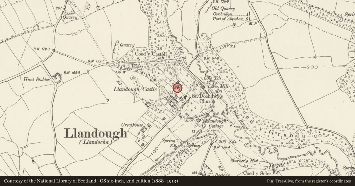
Slide toward Today to fade the historical sheet and see the modern map underneath.
David Rumsey Map Collection, Stanford LibrariesDavid Rumsey Map Collection, Stanford LibrariesDavid Rumsey Map Collection, Stanford LibrariesDavid Rumsey Map Collection, Stanford LibrariesDavid Rumsey Map Collection, Stanford Libraries
5 historical maps cover this location, the earliest the 1636 map "Cornubia : Devonia, Somersetus, Dorcestria, Wiltonia, Glocestria ..." (David Rumsey Map Collection, Stanford Libraries).
Historical maps covering this location
- 1636 · Cornubia : Devonia, Somersetus, Dorcestria, Wiltonia, Glocestria ... (David Rumsey Map Collection, Stanford Libraries)
- 1637 · The fourth table of England. Cornub. Devonia, Somerset etc. (David Rumsey Map Collection, Stanford Libraries)
- 1865 · England and Wales. England No. 6. (David Rumsey Map Collection, Stanford Libraries)
- 1897 · 262 Pontypridd (Hills) (David Rumsey Map Collection, Stanford Libraries)
- 1897 · 262 Pontypridd (Outline) (David Rumsey Map Collection, Stanford Libraries)
Cadw's description
Summary description and reason for designation
The following provides a general description of the Scheduled Ancient Monument.
The monument comprises the remains of a medieval hall. The surviving wall of the hall block may be dated to the late 13th century, but the first substantive period of building dates to the 15th century. Measuring approximately 4m high, it runs NNW-SSE and is 1-1.2m thick. At the northern end is a large fireplace, there is another at the midpoint along the wall, and in the southern end there is another blocked fireplace c. 2.2m high with a small oven built into the wall.
The monument is of national importance for its potential to enhance our knowledge of medieval secular architecture. The monument is a well-preserved example of its type and forms an important element within the wider medieval context. The structure itself may be expected to contain archaeological information in regard to chronology, building techniques and functional detail.
The scheduled area comprises the remains described and areas around them within which related evidence may be expected to survive.
Nearby in the register
- The Gatehouse (including attached boundary walls)Domesticunder 1 mi
- Llandough Castle FlatsDomesticunder 1 mi
- Llandough CastleDomesticunder 1 mi
- NE, SE and SW Walls, Gatepiers and Railings enclosing Landough Castle and GatehouseDomesticunder 1 mi
Other entries of the same register within about three miles of this one, by straight line.