Cof Cymru: National Historic Assets of Wales · Wales
St Mary Church
Flint, Flintshire, Wales
A Grade II listed building in Flint, Flintshire, designated on 11 September 1995.
The record
- Designation
- Listed building, Grade II
- Broad class
- Religious, Ritual and Funerary
- Date of designation
- 11 September 1995
- Community
- Flint
- Unitary authority
- Flintshire
- Country
- Wales
- Coordinates
- 53.24859, -3.13528
- Cadw reference
- 16406
Slide toward Today to fade the historical sheet and see the modern map underneath.
David Rumsey Map Collection, Stanford LibrariesDavid Rumsey Map Collection, Stanford LibrariesDavid Rumsey Map Collection, Stanford LibrariesDavid Rumsey Map Collection, Stanford LibrariesLlyfrgell Genedlaethol Cymru – The National Library of Wales
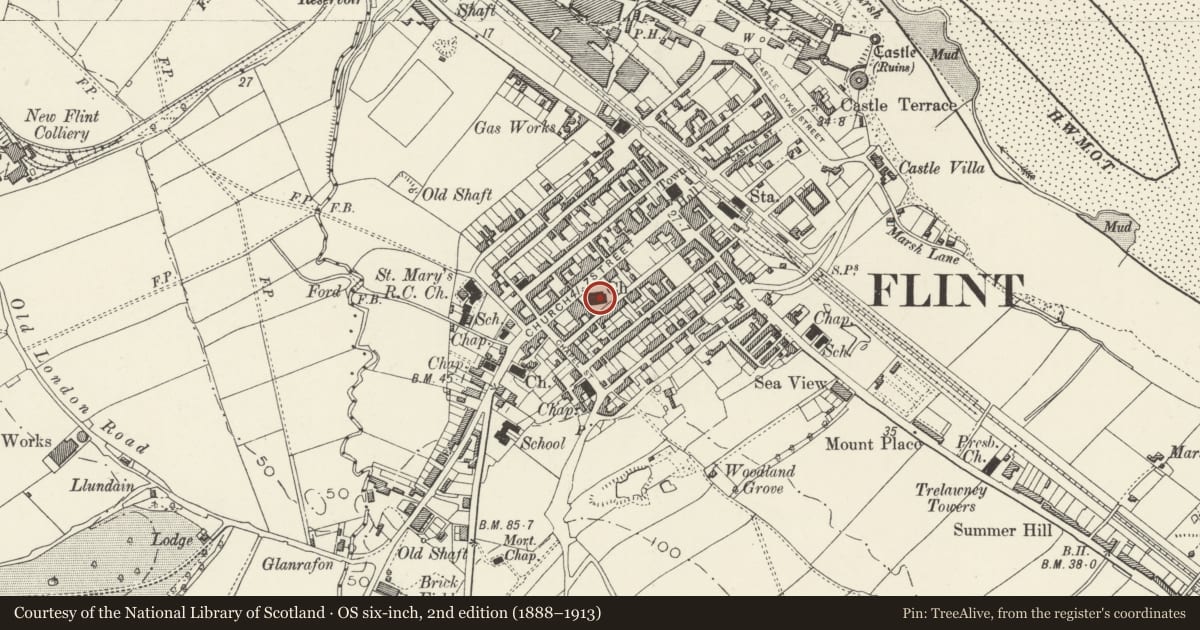
5 historical maps cover this location, the earliest the 1795 map "To Sir Watkin Williams-Wynn Bart ... the map of the six counties of North Wales is most humbly inscribed by his obedient humble servant" (Llyfrgell Genedlaethol Cymru – The National Library of Wales).
Historical maps covering this location
- 1795 · To Sir Watkin Williams-Wynn Bart ... the map of the six counties of North Wales is most… (Llyfrgell Genedlaethol Cymru – The National Library of Wales)
- 1883 · Watershed map England, Wales 3. (David Rumsey Map Collection, Stanford Libraries)
- 1898 · 108 Flint (Hills) (David Rumsey Map Collection, Stanford Libraries)
- 1898 · 108 Flint (Outline) (David Rumsey Map Collection, Stanford Libraries)
- 1901 · Sheet 9 and 10. (David Rumsey Map Collection, Stanford Libraries)
Cadw's description
Location
Between Church Street and Sydney Street, set at an angle to Church Street, oriented E-W.
History
Rebuilt by Ambrose Poynter, architect, 1846-48 on site of medieval church.
Exterior
Coursed brown stone, slate roofs. Eclectic Gothic style. Nave (chancel same height as nave) and aisles, NW corner tower, N transept (organ chamber), N porch. Tower has octagonal stone spire with lucarnes; 2-light Decorated style windows to bell stage; stepped buttresses, clock. To L of tower 4 bays, paired Caernarfon arched windows to clerestorey, broad single-light cusped windows to aisle; porch with modern doors; transept with oculus in gable, 3-light window to ground floor N and E; 3 lancets to E end. South elevation similar to N but lacks transept; instead, lower chapel at E end of aisle, and tall lancet. W end has 3 lancets with trefoil over.
Interior
Spacious interior with camberbeam roof to nave and to chancel; chancel same height as nave with no structural division; roof beams to chancel heavier (possibly later?). Broad arches to aisles have octagonal shafts. Gallery to W end with painted panel of Royal arms (Queen Victoria). Monuments to members of the Muspratt family (who set up alkali works at town); to S of chancel Julia Muspratt (died 1857) by Spence; to N of chancel James and Richard Muspratt (died 1886, and 1885) by E J Physick.
Reason for designation
Included as example of early Victorian Gothic on site of historic parish church.
Nearby in the register
- 34Domesticunder 1 mi
- South African War MemorialCommemorativeunder 1 mi
- War Memorial (CENOTAPH)Commemorativeunder 1 mi
- Palace Social Club (former Plaza Cinema)Recreationalunder 1 mi
Other entries of the same register within about three miles of this one, by straight line.