Cof Cymru: National Historic Assets of Wales · Wales
Bridge 133 over the Montgomeryshire Canal
Berriew, Powys, Wales
A Grade II listed building in Trwst Llywelyn, Berriew, Powys, designated on 21 August 1995.
The record
- Designation
- Listed building, Grade II
- Broad class
- Transport
- Date of designation
- 21 August 1995
- Locality
- Trwst Llywelyn
- Community
- Berriew
- Unitary authority
- Powys
- Country
- Wales
- Coordinates
- 52.57809, -3.19783
- Cadw reference
- 16397
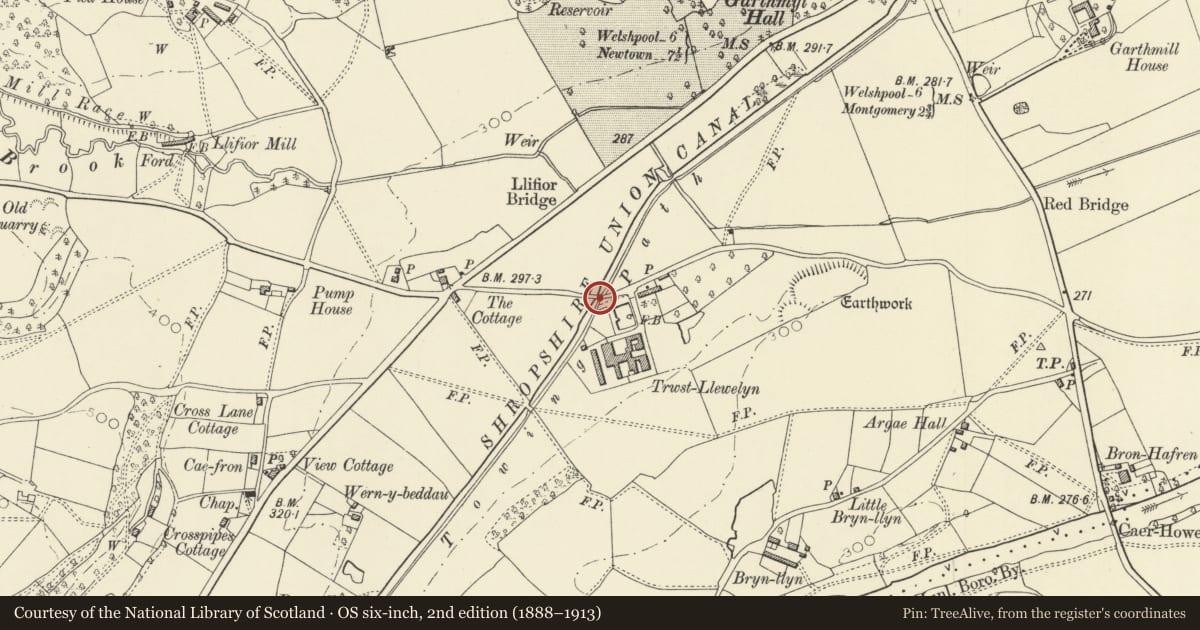
Slide toward Today to fade the historical sheet and see the modern map underneath.
David Rumsey Map Collection, Stanford LibrariesDavid Rumsey Map Collection, Stanford LibrariesLlyfrgell Genedlaethol Cymru – The National Library of WalesDavid Rumsey Map Collection, Stanford LibrariesDavid Rumsey Map Collection, Stanford Libraries
5 historical maps cover this location, the earliest the 1608 map "(13) Cambriae Typus." (David Rumsey Map Collection, Stanford Libraries).
Historical maps covering this location
- 1608 · (13) Cambriae Typus. (David Rumsey Map Collection, Stanford Libraries)
- 1637 · Particular description of Wales. Cambria seu Wallia (David Rumsey Map Collection, Stanford Libraries)
- 1795 · To Sir Watkin Williams-Wynn Bart ... the map of the six counties of North Wales is most… (Llyfrgell Genedlaethol Cymru – The National Library of Wales)
- 1883 · Watershed map England, Wales 3. (David Rumsey Map Collection, Stanford Libraries)
- 1916 · Sheet 60. Shrewsbury. (David Rumsey Map Collection, Stanford Libraries)
Cadw's description
Location
Carries a by-road over the canal at Trwst Llewelyn Farm, 1km approx SW of Garthmyl.
History
The Montgomeryshire Canal was built from Garthmyl to Newtown between 1815 and 1819-21 (Josiah Jessop, engineer); this bridge (with later repairs) forms part of that development.
Exterior
Single span brick arched bridge, with some stone dressings. Outer piers and parapet have pyramidal stone copings, and stone string course marks the position of the road bed. Splayed in plan, and in section rising in a shallow curve. Abutments chamfered on tow-path side. Brick retaining wall to integral pathway to road level on N side. Some later repair work to parapets.
Reason for designation
Listed as part of the original engineering works of the western arm of the Montgomeryshire Canal, retaining much of its original character.
Nearby in the register
- Bridge 134 over the Montgomeryshire CanalTransportunder 1 mi
- Garthmyl HallDomesticunder 1 mi
- Stables at Garthmyl HallDomesticunder 1 mi
- Llifior MillIndustrialunder 1 mi
Other entries of the same register within about three miles of this one, by straight line.