Cof Cymru: National Historic Assets of Wales · Wales
Whittingham's Stores
Berriew, Powys, Wales
A Grade II listed building in Berriew, Powys, designated on 21 August 1995.
The record
- Designation
- Listed building, Grade II
- Broad class
- Commercial
- Date of designation
- 21 August 1995
- Community
- Berriew
- Unitary authority
- Powys
- Country
- Wales
- Coordinates
- 52.59921, -3.20133
- Cadw reference
- 16342
Slide toward Today to fade the historical sheet and see the modern map underneath.
David Rumsey Map Collection, Stanford LibrariesDavid Rumsey Map Collection, Stanford LibrariesDavid Rumsey Map Collection, Stanford LibrariesDavid Rumsey Map Collection, Stanford LibrariesLlyfrgell Genedlaethol Cymru – The National Library of Wales
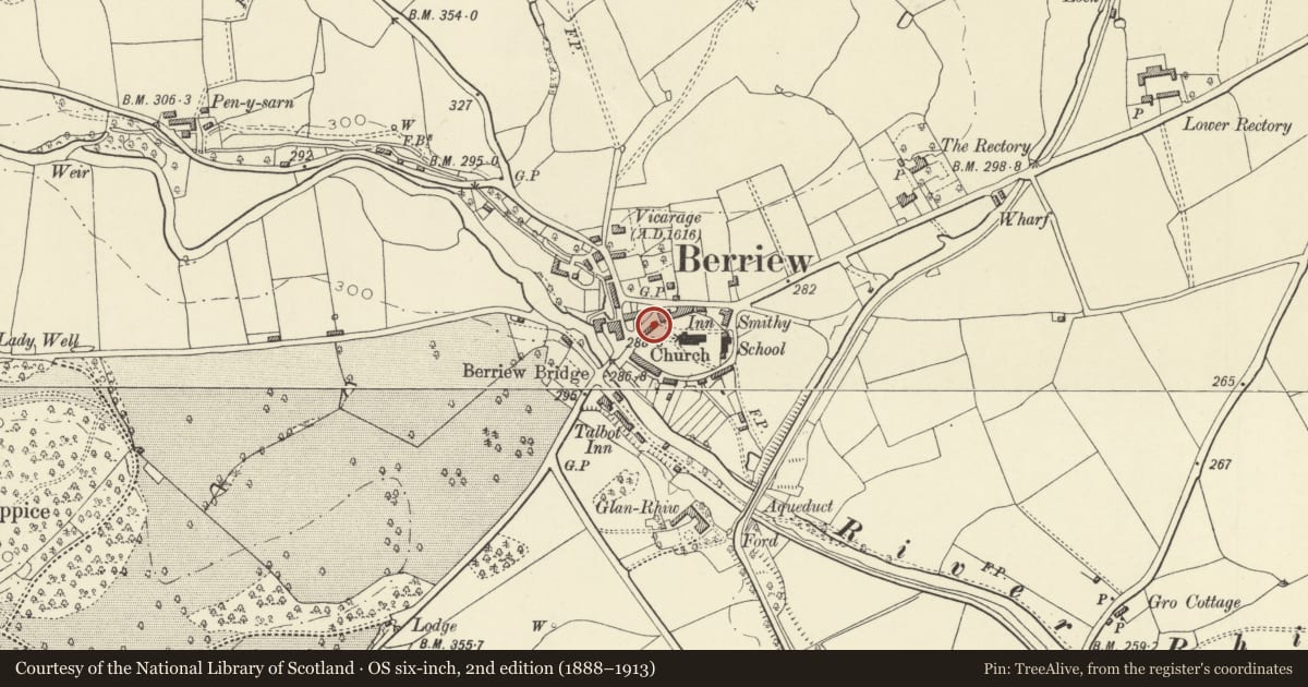
5 historical maps cover this location, the earliest the 1795 map "To Sir Watkin Williams-Wynn Bart ... the map of the six counties of North Wales is most humbly inscribed by his obedient humble servant" (Llyfrgell Genedlaethol Cymru – The National Library of Wales).
Historical maps covering this location
- 1795 · To Sir Watkin Williams-Wynn Bart ... the map of the six counties of North Wales is most… (Llyfrgell Genedlaethol Cymru – The National Library of Wales)
- 1883 · Watershed map England, Wales 3. (David Rumsey Map Collection, Stanford Libraries)
- 1899 · 151 Welshpool (Hills) (David Rumsey Map Collection, Stanford Libraries)
- 1901 · Sheet 9 and 10. (David Rumsey Map Collection, Stanford Libraries)
- 1916 · Sheet 60. Shrewsbury. (David Rumsey Map Collection, Stanford Libraries)
Cadw's description
Location
Prominently sited at the centre of the village, bounding the churchyard adjacent to the Lion Public House.
Exterior
Almost certainly purpose-built as a shop with accommodation in the mid C19, by the Vaynor Estate (an architect's drawing of the building is dated 1857), but possibly the rebuilding of an earlier house on the site (perhaps evidenced by the axial siting of the stack). Painted brick with dentilled eaves band, and slate roof, with axial brick stack. 2 storeys, 4-window range. Shop-front to right, with small paned windows splayed back to either side of central entrance, under a continuous moulded entablature or fascia: Entrance to adjacent accommodation (now partly used as stores) is in the centre of the left hand section of the building: 4-panelled door flanked by 12-pane sash windows on each floor, with a lower 6-pane sash window over the doorway, and a 12-pane sash over the shop. The windows are all in the splayed cases which are a characteristic of Vaynor Estate work of the mid C19.
Reason for designation
A very good example of a mid C19 shop, retaining its original front virtually unaltered, which is part of an important group of buildings at the centre of the village.
Nearby in the register
- Lychgate CottageDomesticunder 1 mi
- Lychgate to ChurchyardCommemorativeunder 1 mi
- The SignDomesticunder 1 mi
- The SignDomesticunder 1 mi
Other entries of the same register within about three miles of this one, by straight line.