Cof Cymru: National Historic Assets of Wales · Wales
Lychgate Cottage
Berriew, Powys, Wales
A Grade II listed building in Berriew, Powys, designated on 21 August 1995.
The record
- Designation
- Listed building, Grade II
- Broad class
- Domestic
- Date of designation
- 21 August 1995
- Community
- Berriew
- Unitary authority
- Powys
- Country
- Wales
- Coordinates
- 52.59914, -3.20148
- Cadw reference
- 16341
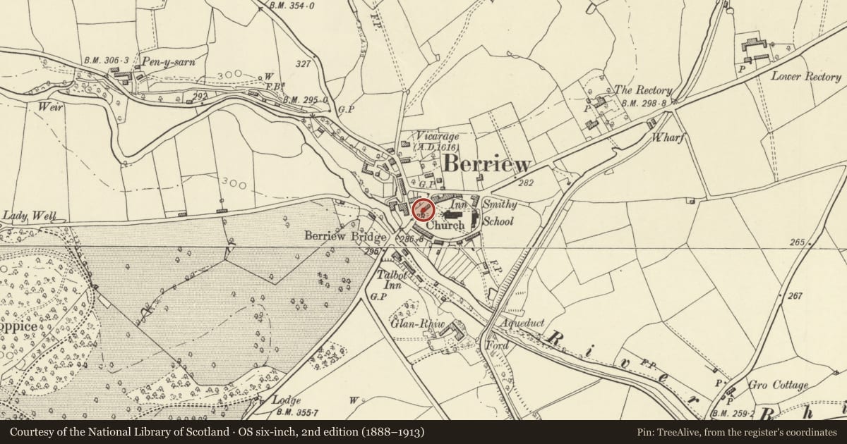
Slide toward Today to fade the historical sheet and see the modern map underneath.
David Rumsey Map Collection, Stanford LibrariesDavid Rumsey Map Collection, Stanford LibrariesDavid Rumsey Map Collection, Stanford LibrariesDavid Rumsey Map Collection, Stanford LibrariesLlyfrgell Genedlaethol Cymru – The National Library of Wales
5 historical maps cover this location, the earliest the 1795 map "To Sir Watkin Williams-Wynn Bart ... the map of the six counties of North Wales is most humbly inscribed by his obedient humble servant" (Llyfrgell Genedlaethol Cymru – The National Library of Wales).
Historical maps covering this location
- 1795 · To Sir Watkin Williams-Wynn Bart ... the map of the six counties of North Wales is most… (Llyfrgell Genedlaethol Cymru – The National Library of Wales)
- 1883 · Watershed map England, Wales 3. (David Rumsey Map Collection, Stanford Libraries)
- 1899 · 151 Welshpool (Hills) (David Rumsey Map Collection, Stanford Libraries)
- 1901 · Sheet 9 and 10. (David Rumsey Map Collection, Stanford Libraries)
- 1916 · Sheet 60. Shrewsbury. (David Rumsey Map Collection, Stanford Libraries)
Cadw's description
Location
Alongside the lychgate entrance to the churchyard, in a prominent position in the middle of the village.
History
The cottage was probably originally built towards the end of the C17, comprising a small 3-unit dwelling. It was extended, probably in the mid C19, by the addition of a shop with accommodation over to the right hand end.
Exterior
Box framed in square panels with painted brick nogging and slate roof, with axial brick stack towards left. Doorway against stack, with 2x2-light casement windows to its right, and a further doorway (to the later shop) at the right hand angle. 2 gabled dormers in the roof. Later shop set back slightly to the right has wide 12-paned shop window of early C19 type to ground floor, and oriel window to first floor of gable return.
Reason for designation
A good example of the local traditions of timber framing applied to a small house in an important village-centre location; the former shop which retains a window of early type, is also of special interest.
Nearby in the register
- Lychgate to ChurchyardCommemorativeunder 1 mi
- Whittingham's StoresCommercialunder 1 mi
- The SignDomesticunder 1 mi
- The SignDomesticunder 1 mi
Other entries of the same register within about three miles of this one, by straight line.