Cof Cymru: National Historic Assets of Wales · Wales
Churchuard Cross at Parish Church of St Mary
St. Nicholas and Bonvilston, Vale of Glamorgan, Wales
A Grade II listed building in Bonvilston, St. Nicholas and Bonvilston, Vale of Glamorgan, designated on 31 July 1995.
The record
- Designation
- Listed building, Grade II
- Broad class
- Religious, Ritual and Funerary
- Date of designation
- 31 July 1995
- Locality
- Bonvilston
- Community
- St. Nicholas and Bonvilston
- Unitary authority
- Vale of Glamorgan
- Country
- Wales
- Coordinates
- 51.45735, -3.34767
- Cadw reference
- 16320
Slide toward Today to fade the historical sheet and see the modern map underneath.
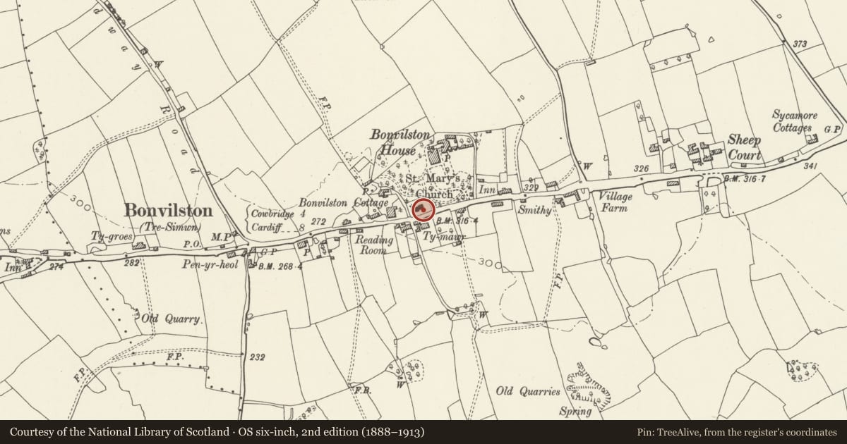
David Rumsey Map Collection, Stanford LibrariesDavid Rumsey Map Collection, Stanford LibrariesDavid Rumsey Map Collection, Stanford LibrariesDavid Rumsey Map Collection, Stanford LibrariesNational Library of Scotland
5 historical maps cover this location, the earliest the 1636 map "Cornubia : Devonia, Somersetus, Dorcestria, Wiltonia, Glocestria ..." (David Rumsey Map Collection, Stanford Libraries).
Historical maps covering this location
- 1636 · Cornubia : Devonia, Somersetus, Dorcestria, Wiltonia, Glocestria ... (David Rumsey Map Collection, Stanford Libraries)
- 1637 · The fourth table of England. Cornub. Devonia, Somerset etc. (David Rumsey Map Collection, Stanford Libraries)
- 1865 · England and Wales. England No. 6. (David Rumsey Map Collection, Stanford Libraries)
- 1895 · Sheet 11. Ordnance Survey of England and Wales. (David Rumsey Map Collection, Stanford Libraries)
- 1930 · OS Popular Edition 1919-1947 (National Library of Scotland)
Cadw's description
Location
Situated in the churchyard immediately to the S of St. Mary's parish church which is located on the N side of the A48 at the W edge of the village, opposite the Great House.
History
Medieval base to church cross restored by public inscription as a memorial to the men of the parish who died in the Great War 1914-1918. The names of five servicemen are inscribed on the replacement block of the top step of the cross facing S. The design was prepared by William Clarke of Llandaff.
Exterior
Four stepped medieval base constructed in limestone block. Each step of two courses of local limestone topped by a roughly hewn, weathered, tapering block of sandstone with plain C20 cross of Forest of Dean sandstone.
Reason for designation
Included for group value with St. Mary's parish church.
Nearby in the register
- Parish Church of St Mary the VirginReligious, Ritual and Funeraryunder 1 mi
- Ty Mawr (Great House)Domesticunder 1 mi
- Bonvilston CottageDomesticunder 1 mi
- Milestone opposite the Old Village Shop, BonvilstonNo class recordedunder 1 mi
Other entries of the same register within about three miles of this one, by straight line.