Cof Cymru: National Historic Assets of Wales · Wales
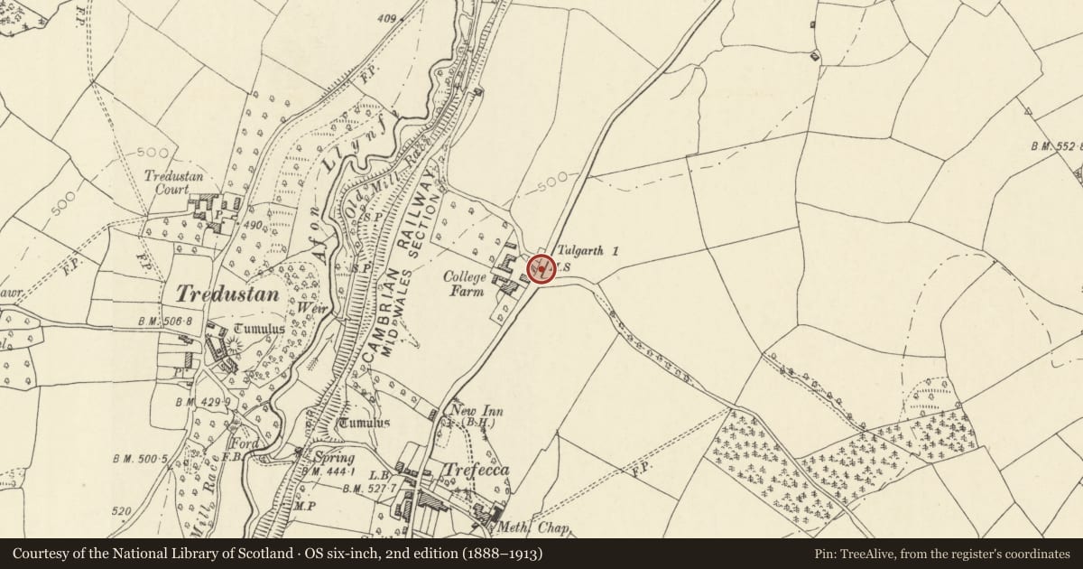
Milestone opposite Trefeca College Farm
Talgarth, Powys, Wales
A Grade II listed building in Trefeca, Talgarth, Powys, designated on 14 August 1995.
The record
- Designation
- Listed building, Grade II
- Broad class
- Transport
- Date of designation
- 14 August 1995
- Locality
- Trefeca
- Community
- Talgarth
- Unitary authority
- Powys
- Country
- Wales
- Coordinates
- 51.98469, -3.24638
- Cadw reference
- 16312
Slide toward Today to fade the historical sheet and see the modern map underneath.
David Rumsey Map Collection, Stanford LibrariesDavid Rumsey Map Collection, Stanford LibrariesDavid Rumsey Map Collection, Stanford LibrariesDavid Rumsey Map Collection, Stanford LibrariesDavid Rumsey Map Collection, Stanford Libraries
5 historical maps cover this location, the earliest the 1608 map "(13) Cambriae Typus." (David Rumsey Map Collection, Stanford Libraries).
Historical maps covering this location
- 1608 · (13) Cambriae Typus. (David Rumsey Map Collection, Stanford Libraries)
- 1636 · Cornubia : Devonia, Somersetus, Dorcestria, Wiltonia, Glocestria ... (David Rumsey Map Collection, Stanford Libraries)
- 1856 · 42. Brecon. (David Rumsey Map Collection, Stanford Libraries)
- 1896 · 214 Talgarth (Hills) (David Rumsey Map Collection, Stanford Libraries)
- 1901 · Sheet 14. (David Rumsey Map Collection, Stanford Libraries)
Cadw's description
Location
Located in the road verge nearly opposite College Farm.
Exterior
Milestone of c1830, a sandstone slab with rounded top, having well formed incised lettering reading TALGARTH / 2
Reason for designation
Included as a survival of the turnpiking of the Hay to Llangors road.
Nearby in the register
- Trefeca College Farmhouse (Trefeca Isaf)Educationunder 1 mi
- 'U'-Plan Range of Farm Buildings at Trefeca College FarmAgriculture and Subsistenceunder 1 mi
- Trefecca Castle MoundMotteunder 1 mi
- Coleg TrefecaDomesticunder 1 mi
Other entries of the same register within about three miles of this one, by straight line.