Cof Cymru: National Historic Assets of Wales · Wales
Highcliffe House
Talgarth, Powys, Wales
A Grade II listed building in Talgarth, Powys, designated on 14 August 1995.
The record
- Designation
- Listed building, Grade II
- Broad class
- Domestic
- Date of designation
- 14 August 1995
- Locality
- Talgarth
- Community
- Talgarth
- Unitary authority
- Powys
- Country
- Wales
- Coordinates
- 51.99561, -3.22907
- Cadw reference
- 16289
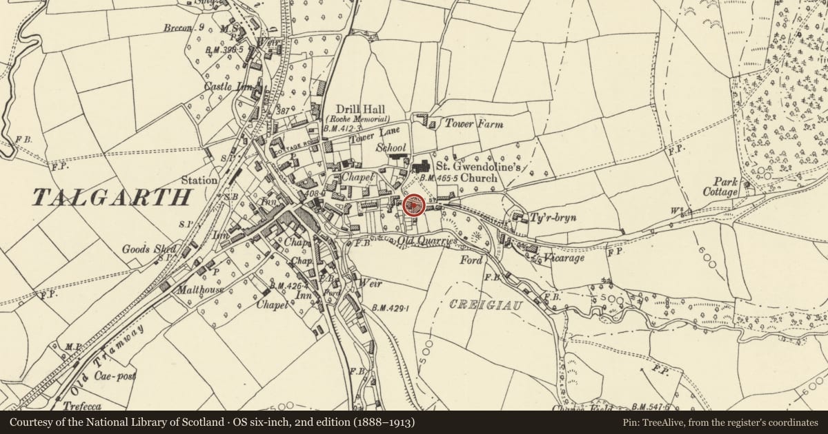
Slide toward Today to fade the historical sheet and see the modern map underneath.
David Rumsey Map Collection, Stanford LibrariesDavid Rumsey Map Collection, Stanford LibrariesDavid Rumsey Map Collection, Stanford LibrariesDavid Rumsey Map Collection, Stanford LibrariesDavid Rumsey Map Collection, Stanford Libraries
5 historical maps cover this location, the earliest the 1608 map "(13) Cambriae Typus." (David Rumsey Map Collection, Stanford Libraries).
Historical maps covering this location
- 1608 · (13) Cambriae Typus. (David Rumsey Map Collection, Stanford Libraries)
- 1636 · Cornubia : Devonia, Somersetus, Dorcestria, Wiltonia, Glocestria ... (David Rumsey Map Collection, Stanford Libraries)
- 1856 · 42. Brecon. (David Rumsey Map Collection, Stanford Libraries)
- 1896 · 214 Talgarth (Hills) (David Rumsey Map Collection, Stanford Libraries)
- 1901 · Sheet 14. (David Rumsey Map Collection, Stanford Libraries)
Cadw's description
Location
Located in a terrace of C19 cottages, one of a row of two within a larger group, and adjoining Merlin House to the E facing over the churchyard.
Exterior
House of the mid C19, originally symmetrical with Merlin House, but later altered. Pebbledashed. Modern 6-panelled door without doorcase. Four-paned late C19 horned sashes, one to ground floor, two to first floor and casement window of same proportions to top floor. Panelled eaves soffit. Roof hipped and stack on party wall.
Reason for designation
Included as of group value with Grade II listed Merlin House, and within a broader group forming the setting for the church.
Nearby in the register
- Merlin HouseDomesticunder 1 mi
- Church House including Gates and Railings to FrontDomesticunder 1 mi
- Crescent HouseDomesticunder 1 mi
- Crescent CottageDomesticunder 1 mi
Other entries of the same register within about three miles of this one, by straight line.