Cof Cymru: National Historic Assets of Wales · Wales
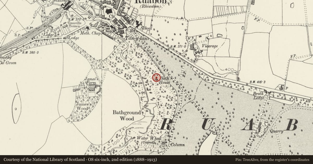
The Bath House Wynnstay
Ruabon, Wrexham, Wales
A Grade II* listed building in Ruabon, Wrexham, designated on 7 June 1963.
The record
- Designation
- Listed building, Grade II*
- Broad class
- Domestic
- Date of designation
- 7 June 1963
- Community
- Ruabon
- Unitary authority
- Wrexham
- Country
- Wales
- Coordinates
- 52.98363, -3.03607
- Cadw reference
- 1628
Slide toward Today to fade the historical sheet and see the modern map underneath.
David Rumsey Map Collection, Stanford LibrariesDavid Rumsey Map Collection, Stanford LibrariesDavid Rumsey Map Collection, Stanford LibrariesDavid Rumsey Map Collection, Stanford LibrariesLlyfrgell Genedlaethol Cymru – The National Library of Wales
5 historical maps cover this location, the earliest the 1795 map "To Sir Watkin Williams-Wynn Bart ... the map of the six counties of North Wales is most humbly inscribed by his obedient humble servant" (Llyfrgell Genedlaethol Cymru – The National Library of Wales).
Historical maps covering this location
- 1795 · To Sir Watkin Williams-Wynn Bart ... the map of the six counties of North Wales is most… (Llyfrgell Genedlaethol Cymru – The National Library of Wales)
- 1883 · Watershed map England, Wales 3. (David Rumsey Map Collection, Stanford Libraries)
- 1898 · 121 Wrexham (Hills) (David Rumsey Map Collection, Stanford Libraries)
- 1898 · 121 Wrexham (Outline) (David Rumsey Map Collection, Stanford Libraries)
- 1901 · Sheet 9 and 10. (David Rumsey Map Collection, Stanford Libraries)
Cadw's description
Location
Situated within Wynnstay Park, 450m S of Ruabon in Bathground Wood. Reached from a drive running S off the slip road to the A539 E bound off the A483 at Ruabon.
History
Possibly designed by James Wyatt c1784, possibly with later work by Thomas Harrison. Now converted into dwelling.
Exterior
Late C18 bath house, sandstone ashlar with plinth and entablature. Main south elevation Doric tetrastyle portico with flanking side bays containing recessed niches with moulded architraves, hipped slate roof central stack. Four stone steps lead down to rectangular plunge pool. Right hand return elevation retains 4-pane sashes to first floor, modern windows below. Similar left hand return elevation. 2-storey late C20 rear extension which returns on to northern elevation. Interior altered in conversion to dwelling.
Reason for designation
Listed as a distinguished architectural composition which externally retains much of its original character.
Group value with the surviving listed structures associated with the important park and garden at Wynnstay.
Nearby in the register
- Plunge PoolWater Supply and Drainageunder 1 mi
- Ruabon Gates (also known as Wynnstay Gates and Archway)Domesticunder 1 mi
- The Gate House (also known as Park / Gate Lodge)Domesticunder 1 mi
- Sluice OutletGardens, Parks and Urban Spacesunder 1 mi
Other entries of the same register within about three miles of this one, by straight line.