Cof Cymru: National Historic Assets of Wales · Wales
Sluice Outlet
Ruabon, Wrexham, Wales
A Grade II listed building in Wynnstay, Ruabon, Wrexham, designated on 22 February 1995.
The record
- Designation
- Listed building, Grade II
- Broad class
- Gardens, Parks and Urban Spaces
- Date of designation
- 22 February 1995
- Locality
- Wynnstay
- Community
- Ruabon
- Unitary authority
- Wrexham
- Country
- Wales
- Coordinates
- 52.98081, -3.03780
- Cadw reference
- 15748
Slide toward Today to fade the historical sheet and see the modern map underneath.
David Rumsey Map Collection, Stanford LibrariesDavid Rumsey Map Collection, Stanford LibrariesDavid Rumsey Map Collection, Stanford LibrariesDavid Rumsey Map Collection, Stanford LibrariesLlyfrgell Genedlaethol Cymru – The National Library of Wales
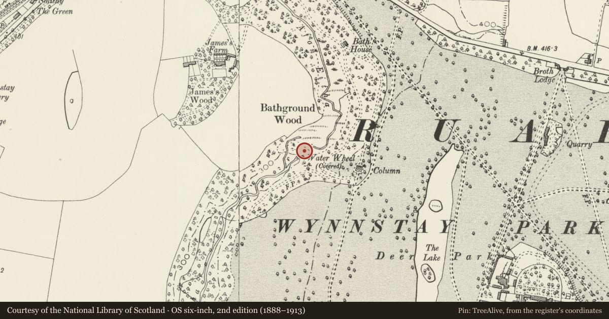
5 historical maps cover this location, the earliest the 1795 map "To Sir Watkin Williams-Wynn Bart ... the map of the six counties of North Wales is most humbly inscribed by his obedient humble servant" (Llyfrgell Genedlaethol Cymru – The National Library of Wales).
Historical maps covering this location
- 1795 · To Sir Watkin Williams-Wynn Bart ... the map of the six counties of North Wales is most… (Llyfrgell Genedlaethol Cymru – The National Library of Wales)
- 1883 · Watershed map England, Wales 3. (David Rumsey Map Collection, Stanford Libraries)
- 1898 · 121 Wrexham (Hills) (David Rumsey Map Collection, Stanford Libraries)
- 1898 · 121 Wrexham (Outline) (David Rumsey Map Collection, Stanford Libraries)
- 1901 · Sheet 9 and 10. (David Rumsey Map Collection, Stanford Libraries)
Cadw's description
Location
Remotely sited within Wynnstay Park; in Bathground Wood 50m to the west of the Cascade.
History
Part of a major programme of works undertaken by Sir Watkin Williams-Wynn, 4th bt., to the park and garden between 1768 and 1789. An ambitious scheme for a lake and cascade was drawn up by Lancelot `Capability' Brown. Following Brown's death the scheme was executed, possibly in altered form, by John Evans. The sluice outlet is part of the scheme for the management of the lake's water level.
Exterior
Dressed stone outlet set into the ground. Round arch rises from imposts. Entrance leads to barrel vaulted tunnel of brick and stone construction.
Reason for designation
Listed as part of an important water garden scheme designed by Brown.
Group value with the other garden structures relating to this important period of improvements to the park and gardens at Wynnstay.
Nearby in the register
- CascadeGardens, Parks and Urban Spacesunder 1 mi
- Ice HouseDomesticunder 1 mi
- Wynnstay ColumnCommemorativeunder 1 mi
- Plunge PoolWater Supply and Drainageunder 1 mi
Other entries of the same register within about three miles of this one, by straight line.