Cof Cymru: National Historic Assets of Wales · Wales
Salisbury Farmhouse
Caerwent, Monmouthshire, Wales
A Grade II listed building in St Brides, Caerwent, Monmouthshire, designated on 31 May 1995.
The record
- Designation
- Listed building, Grade II
- Broad class
- Domestic
- Date of designation
- 31 May 1995
- Locality
- St Brides
- Community
- Caerwent
- Unitary authority
- Monmouthshire
- Country
- Wales
- Coordinates
- 51.59620, -2.83080
- Cadw reference
- 16069
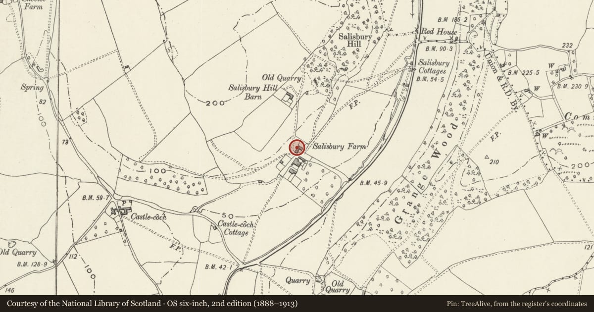
Slide toward Today to fade the historical sheet and see the modern map underneath.
David Rumsey Map Collection, Stanford LibrariesDavid Rumsey Map Collection, Stanford LibrariesDavid Rumsey Map Collection, Stanford LibrariesDavid Rumsey Map Collection, Stanford LibrariesDavid Rumsey Map Collection, Stanford Libraries
5 historical maps cover this location, the earliest the 1636 map "Cornubia : Devonia, Somersetus, Dorcestria, Wiltonia, Glocestria ..." (David Rumsey Map Collection, Stanford Libraries).
Historical maps covering this location
- 1636 · Cornubia : Devonia, Somersetus, Dorcestria, Wiltonia, Glocestria ... (David Rumsey Map Collection, Stanford Libraries)
- 1895 · Sheet 11. Ordnance Survey of England and Wales. (David Rumsey Map Collection, Stanford Libraries)
- 1897 · 250 Chepstow (Outline) (David Rumsey Map Collection, Stanford Libraries)
- 1905 · 250 Chepstow (Hills) (David Rumsey Map Collection, Stanford Libraries)
- 1913 · Sheet 102. Newport. (David Rumsey Map Collection, Stanford Libraries)
Cadw's description
Location
Located to the north of the community near the boundary with St Brides Netherwent.
History
Early C19 late-Georgian farmhouse.
Exterior
3 storeys to front and 2 to rear under catslide roof and cellar. Of rubble and brick rendered, Welsh slate low pitched roof with brick end stacks. Three window front with horned 16-pane sashes in reveals with narrow sills; and 8-pane sashes to top floor; ground floor has central porch with flat leaded hood supported by slender cast-iron piers and 3 steps to central 6 panelled door with overlight. Central arched opening at rear.
Renovation in progress at time of inspection (October 1994).
Interior
Central staircase with curved handrail and masked stick balusters; grey marble fireplace in sitting-room; 6 panelled doors and matching doorcases and some surviving panelling to windows; some stone flagged floors; high cross beams some boxed. Vaulted cellar with curved stone stairs.
Reason for designation
Listed for its special interest as a mostly unaltered early C19 house.
Nearby in the register
- Church of St BridgetReligious, Ritual and Funeraryunder 1 mi
- St Brides Netherwent Deserted VillageDeserted Medieval Villageunder 1 mi
- The Larches CampHillfortunder 1 mi
- The VicarageDomesticunder 1 mi
Other entries of the same register within about three miles of this one, by straight line.