Cof Cymru: National Historic Assets of Wales · Wales
Former House at Rhedyn Cochion (also known as Ffranc).
Brithdir and Llanfachreth, Gwynedd, Wales
A Grade II listed building in Ty Cerrig, Brithdir and Llanfachreth, Gwynedd, designated on 26 May 1995.
The record
- Designation
- Listed building, Grade II
- Broad class
- Domestic
- Date of designation
- 26 May 1995
- Locality
- Ty Cerrig
- Community
- Brithdir and Llanfachreth
- Unitary authority
- Gwynedd
- Country
- Wales
- Coordinates
- 52.77004, -3.82147
- Cadw reference
- 16060
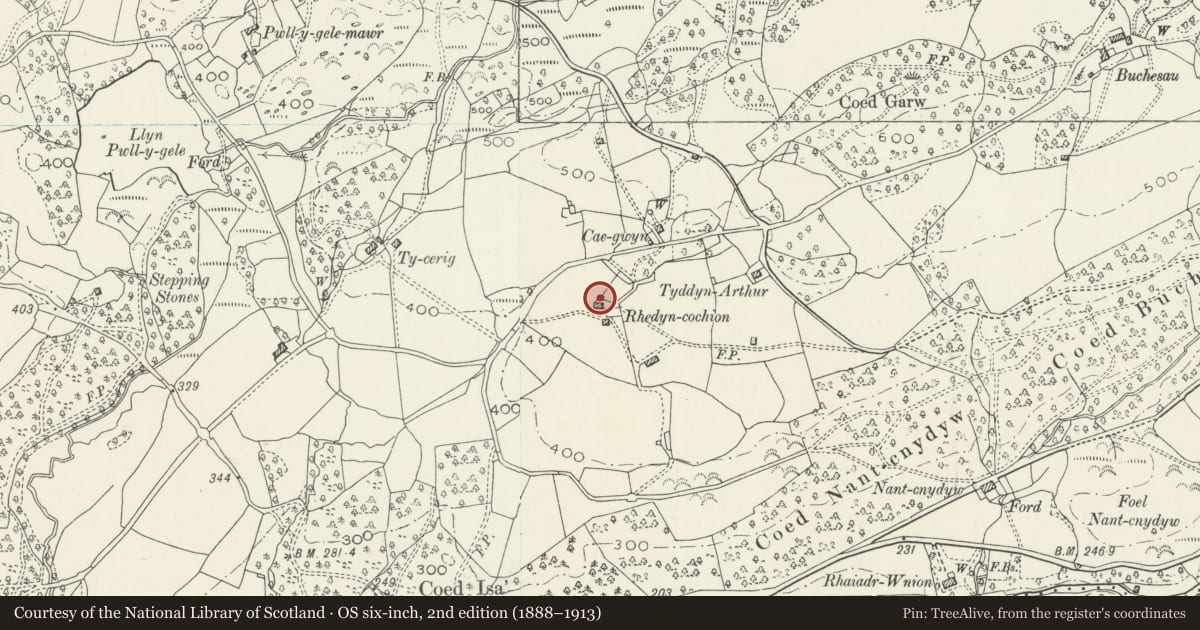
Slide toward Today to fade the historical sheet and see the modern map underneath.
David Rumsey Map Collection, Stanford LibrariesDavid Rumsey Map Collection, Stanford LibrariesLlyfrgell Genedlaethol Cymru – The National Library of WalesDavid Rumsey Map Collection, Stanford LibrariesDavid Rumsey Map Collection, Stanford Libraries
5 historical maps cover this location, the earliest the 1795 map "To Sir Watkin Williams-Wynn Bart ... the map of the six counties of North Wales is most humbly inscribed by his obedient humble servant" (Llyfrgell Genedlaethol Cymru – The National Library of Wales).
Historical maps covering this location
- 1795 · To Sir Watkin Williams-Wynn Bart ... the map of the six counties of North Wales is most… (Llyfrgell Genedlaethol Cymru – The National Library of Wales)
- 1830 · V.3:11-15:XV. Britisches Reich. A. Kon: England. b. Frstenthum Wales: Shire: 37-40 (David Rumsey Map Collection, Stanford Libraries)
- 1883 · Watershed map England, Wales 3. (David Rumsey Map Collection, Stanford Libraries)
- 1899 · 135 Harlech (Hills) (David Rumsey Map Collection, Stanford Libraries)
- 1901 · Sheet 9 and 10. (David Rumsey Map Collection, Stanford Libraries)
Cadw's description
Location
Located approximately 0.5Km NE of the Pont Newydd, N of the Afon Wnion and the A 494 Dolgellau-Bala road; accessed via a lane running roughly W from the Llyn-Pwll-y-Gele ultimately up to Blaenau locality; set in a farmyard immediately N of the present, la
Exterior
Late C17 single-storey rubble farmhouse partly built on rock and with old, undulating slate roof; large, projecting gabled end stack to the E with plain capping and weather-coursing. The S (entrance) side has a plain C19 cart entrance to the L with a boarded door to R and an unglazed window beyond. The N side has aboarded door (formerly a window) to the L and 2 blocked windows to R. Later buttressing to W gable end.
Interior
4-bay with a modern dividing wall separating off the chimney bay; pegged collar trusses, flagged floor. Fireplace with bressummer beyond wall.
Reason for designation
A C17 vernacular farmhouse with projecting end stack, a relatively scarce regional feature.
Nearby in the register
- Ty CerrigDomesticunder 1 mi
- Bont NewyddTransportunder 1 mi
- Dol-GaneddDomesticunder 1 mi
- Barn Range to the SE of Dol-GameddAgriculture and Subsistenceunder 1 mi
Other entries of the same register within about three miles of this one, by straight line.