Cof Cymru: National Historic Assets of Wales · Wales
Former Llay Hall Colliery Chimney and Flue
Gwersyllt, Wrexham, Wales
A Grade II listed building in Sydallt, Gwersyllt, Wrexham, designated on 26 September 1994.
The record
- Designation
- Listed building, Grade II
- Broad class
- Industrial
- Date of designation
- 26 September 1994
- Locality
- Sydallt
- Community
- Gwersyllt
- Unitary authority
- Wrexham
- Country
- Wales
- Coordinates
- 53.08824, -3.02396
- Cadw reference
- 15830
Slide toward Today to fade the historical sheet and see the modern map underneath.
David Rumsey Map Collection, Stanford LibrariesDavid Rumsey Map Collection, Stanford LibrariesDavid Rumsey Map Collection, Stanford LibrariesLlyfrgell Genedlaethol Cymru – The National Library of WalesDavid Rumsey Map Collection, Stanford Libraries
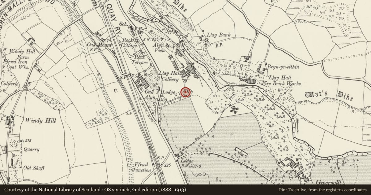
5 historical maps cover this location, the earliest the 1608 map "(13) Cambriae Typus." (David Rumsey Map Collection, Stanford Libraries).
Historical maps covering this location
- 1608 · (13) Cambriae Typus. (David Rumsey Map Collection, Stanford Libraries)
- 1795 · To Sir Watkin Williams-Wynn Bart ... the map of the six counties of North Wales is most… (Llyfrgell Genedlaethol Cymru – The National Library of Wales)
- 1883 · Watershed map England, Wales 3. (David Rumsey Map Collection, Stanford Libraries)
- 1898 · 121 Wrexham (Hills) (David Rumsey Map Collection, Stanford Libraries)
- 1901 · Sheet 9 and 10. (David Rumsey Map Collection, Stanford Libraries)
Cadw's description
Location
Located in the group of former Llay Hall Colliery buildings in use as an industrial estate east of Mold Road. The chimney is high on the slope to the west of the site, close to Mold Road.
History
The flue extends down the slope from the chimney and terminates at the side of the lane.
Llay Hall Colliery operated from 1877 until 1948. It was sunk by the Llay Hall Coal, Iron and Fireclay Company and worked in association with a fire brick works on the opposite side of the River Alyn. It was nationalised in 1947 but closed shortly afterwards, following a serious underground explosion. The chimney and flue serviced the steam boilers for the colliery and probably date from the 1890s.
Exterior
The chimney is of square section in red brick, and tapers slightly to a height of approximately 25-30m. There are corbelled bands around the base and just below the top. The flue extends in a straight line for approximately 50m to the north, beginning just below ground level and then constructed on the surface following the line of the slope to the bottom. At the edge of the lane it passes through a stone cross-wall and comes to an end near the former position of the boilers. The flue is built with vertical side walls of red brick with a concrete slab top.
Reason for designation
Listed as a particularly fine example of a colliery chimney with an unusually long approach flue. The chimney is a prominent local landmark and has group value with the associated former colliery buildings.
Nearby in the register
- Former Llay Hall Collery Engine HouseIndustrialunder 1 mi
- Former Llay Hall Colliery Washery BuildingIndustrialunder 1 mi
- Former Llay Hall Colliery WorkshopsCommercialunder 1 mi
- Rock CottageDomesticunder 1 mi
Other entries of the same register within about three miles of this one, by straight line.