Cof Cymru: National Historic Assets of Wales · Wales
Former Barn at Garth Isaf
Arthog, Gwynedd, Wales
A Grade II listed building in Garth Isaf, Arthog, Gwynedd, designated on 1 February 1995.
The record
- Designation
- Listed building, Grade II
- Broad class
- Agriculture and Subsistence
- Date of designation
- 1 February 1995
- Locality
- Garth Isaf
- Community
- Arthog
- Unitary authority
- Gwynedd
- Country
- Wales
- Coordinates
- 52.72534, -3.99493
- Cadw reference
- 15601
Slide toward Today to fade the historical sheet and see the modern map underneath.
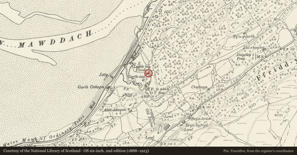
David Rumsey Map Collection, Stanford LibrariesDavid Rumsey Map Collection, Stanford LibrariesDavid Rumsey Map Collection, Stanford LibrariesLlyfrgell Genedlaethol Cymru – The National Library of WalesDavid Rumsey Map Collection, Stanford Libraries
5 historical maps cover this location, the earliest the 1795 map "To Sir Watkin Williams-Wynn Bart ... the map of the six counties of North Wales is most humbly inscribed by his obedient humble servant" (Llyfrgell Genedlaethol Cymru – The National Library of Wales).
Historical maps covering this location
- 1795 · To Sir Watkin Williams-Wynn Bart ... the map of the six counties of North Wales is most… (Llyfrgell Genedlaethol Cymru – The National Library of Wales)
- 1883 · Watershed map England, Wales 3. (David Rumsey Map Collection, Stanford Libraries)
- 1896 · Sheet 7. Ordnance Survey of England and Wales. (David Rumsey Map Collection, Stanford Libraries)
- 1899 · 149 Barmouth (Hills) (David Rumsey Map Collection, Stanford Libraries)
- 1901 · Sheet 9 and 10. (David Rumsey Map Collection, Stanford Libraries)
Cadw's description
Location
Located to the N of the main house, at the far end of the group at Garth Isaf and beyond a part-demolished former barn dated 1672.
Exterior
Long 6-bay rubble barn, its E gable set into the slopeof the hill; probably second quarter C17. Slate roofs, the 2 left-hand bays with old slates; rubble gable parapet to E with former loading bay now a window. Entrance to L with projecting stone lintel and deeply-recessed boarded door. Above, a rubble loading bay (blocked) with hipped roof. Blocked ventilation slitto L of door. To R large mid C20 part-glazed garage doors and further entrance to far R with recessed boarded door. Further (open) dormer loading bay to rear, as before and window to L withslate lintel (former entrance). Upper boarded loading bay to W gable.
Interior
Original pegged collar trusses with restorations; 2 tiers of overlapping purlins. Rubble dividing wall between bays 2 and 3.
Reason for designation
Included for group value with other listed items at Garth Isaf.
Nearby in the register
- Cottage at Garth IsafDomesticunder 1 mi
- Garth Isaf FarmhouseDomesticunder 1 mi
- Secondary House at Garth IsafDomesticunder 1 mi
- MilepostTransportunder 1 mi
Other entries of the same register within about three miles of this one, by straight line.