Cof Cymru: National Historic Assets of Wales · Wales
Secondary House at Garth Isaf
Arthog, Gwynedd, Wales
A Grade II listed building in Garth Isaf, Arthog, Gwynedd, designated on 1 February 1995.
The record
- Designation
- Listed building, Grade II
- Broad class
- Domestic
- Date of designation
- 1 February 1995
- Locality
- Garth Isaf
- Community
- Arthog
- Unitary authority
- Gwynedd
- Country
- Wales
- Coordinates
- 52.72470, -3.99509
- Cadw reference
- 15600
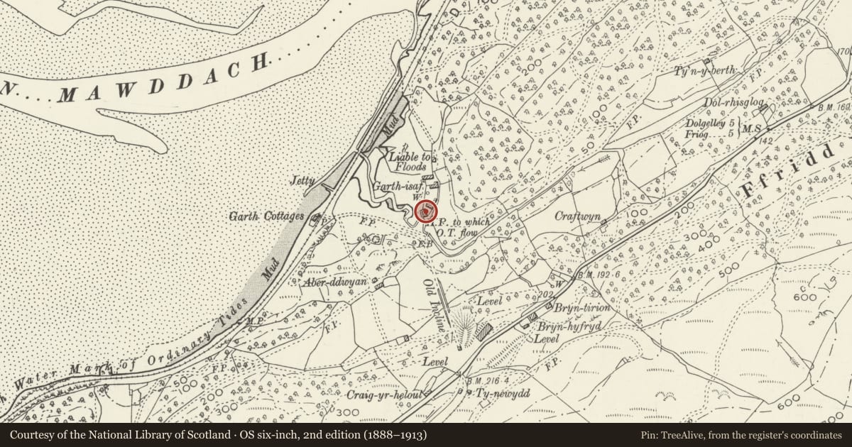
Slide toward Today to fade the historical sheet and see the modern map underneath.
David Rumsey Map Collection, Stanford LibrariesDavid Rumsey Map Collection, Stanford LibrariesDavid Rumsey Map Collection, Stanford LibrariesLlyfrgell Genedlaethol Cymru – The National Library of WalesDavid Rumsey Map Collection, Stanford Libraries
5 historical maps cover this location, the earliest the 1795 map "To Sir Watkin Williams-Wynn Bart ... the map of the six counties of North Wales is most humbly inscribed by his obedient humble servant" (Llyfrgell Genedlaethol Cymru – The National Library of Wales).
Historical maps covering this location
- 1795 · To Sir Watkin Williams-Wynn Bart ... the map of the six counties of North Wales is most… (Llyfrgell Genedlaethol Cymru – The National Library of Wales)
- 1883 · Watershed map England, Wales 3. (David Rumsey Map Collection, Stanford Libraries)
- 1896 · Sheet 7. Ordnance Survey of England and Wales. (David Rumsey Map Collection, Stanford Libraries)
- 1899 · 149 Barmouth (Hills) (David Rumsey Map Collection, Stanford Libraries)
- 1901 · Sheet 9 and 10. (David Rumsey Map Collection, Stanford Libraries)
Cadw's description
Location
Located to the rear (SW) of the main house at Garth Isaf and built against the slope of the ground to the NE; facing the Mawddach estuary.
Exterior
A late C17 2-storey house, perhaps a former dower house, altered C19. Rubble construction with old slate roof; end chimney to NW gable with weather coursing and good moulded
capping. SW (main) face behind low coped rubble wall; off-centre entrance (to L) with boarded door. To L a modern 6-pane window and to R a small 4-pane casement. Further door to far R as
before with small 2-pane window to L. Under the eaves, 4 small, equally-spaced 4-pane casement windows with projecting slate cills. Stone steps up to entrance at L to rear with boarded door; small dwarf-rubble-walled enclosure in front and to the R at ground level a boarded, shuttered window. Blocked window opening to R with projecting slate lintel.
Adjoining to the L gable end a small, single-storey addition with rubble gable parapet and old slate roof; weather coursing at junction with main block. Boarded door to rear and modern window
to NW.
Interior
Part-cobbled floor; large, blocked fireplace to L gable end; some run-off chamfered ceiling beams.
Reason for designation
Group value with the associated listed items at Garth Isaf
Nearby in the register
- Garth Isaf FarmhouseDomesticunder 1 mi
- Cottage at Garth IsafDomesticunder 1 mi
- Former Barn at Garth IsafAgriculture and Subsistenceunder 1 mi
- MilepostTransportunder 1 mi
Other entries of the same register within about three miles of this one, by straight line.