Cof Cymru: National Historic Assets of Wales · Wales
Cooksbridge Farmhouse
Rossett, Wrexham, Wales
A Grade II listed building in Allington, Rossett, Wrexham, designated on 7 June 1963.
The record
- Designation
- Listed building, Grade II
- Broad class
- Domestic
- Date of designation
- 7 June 1963
- Locality
- Allington
- Community
- Rossett
- Unitary authority
- Wrexham
- Country
- Wales
- Coordinates
- 53.10180, -2.92442
- Cadw reference
- 1557
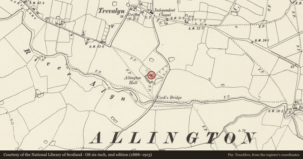
Slide toward Today to fade the historical sheet and see the modern map underneath.
David Rumsey Map Collection, Stanford LibrariesDavid Rumsey Map Collection, Stanford LibrariesDavid Rumsey Map Collection, Stanford LibrariesDavid Rumsey Map Collection, Stanford LibrariesNational Library of Scotland
5 historical maps cover this location, the earliest the 1608 map "(13) Cambriae Typus." (David Rumsey Map Collection, Stanford Libraries).
Historical maps covering this location
- 1608 · (13) Cambriae Typus. (David Rumsey Map Collection, Stanford Libraries)
- 1637 · Particular description of Wales. Cambria seu Wallia (David Rumsey Map Collection, Stanford Libraries)
- 1883 · Watershed map England, Wales 3. (David Rumsey Map Collection, Stanford Libraries)
- 1901 · Sheet 9 and 10. (David Rumsey Map Collection, Stanford Libraries)
- 1930 · OS Popular Edition 1919-1947 (National Library of Scotland)
Cadw's description
Location
Situated in open agricultural land near the junction of Rossett Road and Park Lane with the River Alyn, and Cook's Bridge, to the south.
History
Early C17 timber-framed hall house altered and extended in the C19 when it became a farm.
Exterior
Two storey, timber-frame, and brick built farmhouse rendered with grey grit. New hardwood windows throughout. Pitched slate roof. Built on a H-plan with gabled cross wings. Further cross-wing added to the southern end in the C19 and extension to northern cross wing.
Interior
Original planform largely intact, retains some original features including close string staircase with Jacobean splat balusters and square newel post. Timber box-framing revealed and left exposed following recent internal work, bevelled floor beams. To the east a room with curved tie-beams to second storey.
Reason for designation
Listed as a surviving example of an early C17 H-plan house preserving historic character internally.
Nearby in the register
- Cook's BridgeTransportunder 1 mi
- Trevalyn FarmhouseDomesticunder 1 mi
- Hem HouseDomesticunder 1 mi
- Former Stable-block to NE of Trevalyn HospitalHealth and Welfareunder 1 mi
Other entries of the same register within about three miles of this one, by straight line.