Cof Cymru: National Historic Assets of Wales · Wales
Wern Bridge
Guilsfield, Powys, Wales
A Grade II listed building in Wern, Guilsfield, Powys, designated on 29 December 1994.
The record
- Designation
- Listed building, Grade II
- Broad class
- Transport
- Date of designation
- 29 December 1994
- Locality
- Wern
- Community
- Guilsfield
- Unitary authority
- Powys
- Country
- Wales
- Coordinates
- 52.71510, -3.10768
- Cadw reference
- 15438
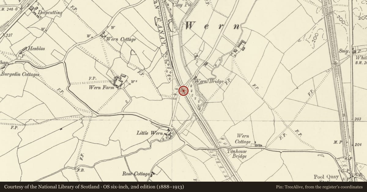
Slide toward Today to fade the historical sheet and see the modern map underneath.
David Rumsey Map Collection, Stanford LibrariesDavid Rumsey Map Collection, Stanford LibrariesDavid Rumsey Map Collection, Stanford LibrariesDavid Rumsey Map Collection, Stanford LibrariesLlyfrgell Genedlaethol Cymru – The National Library of Wales
5 historical maps cover this location, the earliest the 1795 map "To Sir Watkin Williams-Wynn Bart ... the map of the six counties of North Wales is most humbly inscribed by his obedient humble servant" (Llyfrgell Genedlaethol Cymru – The National Library of Wales).
Historical maps covering this location
- 1795 · To Sir Watkin Williams-Wynn Bart ... the map of the six counties of North Wales is most… (Llyfrgell Genedlaethol Cymru – The National Library of Wales)
- 1883 · Watershed map England, Wales 3. (David Rumsey Map Collection, Stanford Libraries)
- 1899 · 151 Welshpool (Hills) (David Rumsey Map Collection, Stanford Libraries)
- 1901 · Sheet 9 and 10. (David Rumsey Map Collection, Stanford Libraries)
- 1916 · Sheet 60. Shrewsbury. (David Rumsey Map Collection, Stanford Libraries)
Cadw's description
Location
Canal bridge No. 107 over the Montgomeryshire Canal.
History
c.1820-33, G Buck, Engineer.
Exterior
Stone coping brick abutments with later blue engineering brick chamfered vertical corners. Applied iron strips to protect corners on towpath. Bridge of five fish-bellied cast iron 'T'-joists with 170x40mm bottom flange, depth 210-280mm, the outer joist cast with pockets for timber guard rail, all bearing on stone padstones. Roadway carried on probably original 70mm x 305mm hardwood planks spanning between beams. No numbered identity plate. Canal revetted with concrete.
The course of the canal between Red Bridge and Wern Bridge is raised on a high embankment, the borrow pits along the canal having later been used for growing osiers, and as a source of puddling clay during the construction of the canal, and from 1824 as a source for brick earth
Reason for designation
One of a number of ironwork structures added during engineering improvements to the canal in early C19.
Nearby in the register
- Tanhouse BridgeTransportunder 1 mi
- Gauging Weir Structures at the Wern, Wern MillTransportunder 1 mi
- Wern Outfall Weir, Wern MillTransportunder 1 mi
- Land Owership Marker Post, Wern MillTransportunder 1 mi
Other entries of the same register within about three miles of this one, by straight line.