Cof Cymru: National Historic Assets of Wales · Wales
The Vine
Llandrinio, Powys, Wales
A Grade II listed building in The Green, Llandrinio, Powys, designated on 29 December 1994.
The record
- Designation
- Listed building, Grade II
- Broad class
- Commercial
- Date of designation
- 29 December 1994
- Locality
- The Green
- Community
- Llandrinio
- Unitary authority
- Powys
- Country
- Wales
- Coordinates
- 52.72754, -3.10560
- Cadw reference
- 15424
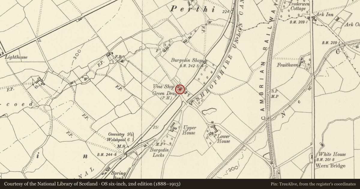
Slide toward Today to fade the historical sheet and see the modern map underneath.
David Rumsey Map Collection, Stanford LibrariesDavid Rumsey Map Collection, Stanford LibrariesDavid Rumsey Map Collection, Stanford LibrariesDavid Rumsey Map Collection, Stanford LibrariesLlyfrgell Genedlaethol Cymru – The National Library of Wales
5 historical maps cover this location, the earliest the 1795 map "To Sir Watkin Williams-Wynn Bart ... the map of the six counties of North Wales is most humbly inscribed by his obedient humble servant" (Llyfrgell Genedlaethol Cymru – The National Library of Wales).
Historical maps covering this location
- 1795 · To Sir Watkin Williams-Wynn Bart ... the map of the six counties of North Wales is most… (Llyfrgell Genedlaethol Cymru – The National Library of Wales)
- 1883 · Watershed map England, Wales 3. (David Rumsey Map Collection, Stanford Libraries)
- 1899 · 151 Welshpool (Hills) (David Rumsey Map Collection, Stanford Libraries)
- 1901 · Sheet 9 and 10. (David Rumsey Map Collection, Stanford Libraries)
- 1916 · Sheet 60. Shrewsbury. (David Rumsey Map Collection, Stanford Libraries)
Cadw's description
Location
The building stands at The Green, raised above above the NW side of the road from Ardd-l_n to Guilsfield.
History
House with shop, formerly the Green Dragon Inn. Early to mid C19.
Exterior
Red brick in Flemish bond, hipped slate roof. Two storeys, 3 bays double pile plan with central stair hall and stacks between font and rear rooms, and, added to left, a 1+ storey 2 bay shop. House has central door, 1930's sunray pattern, with fanlight within an added gabled porch. Sixteen-paned sashes with rubbed brick flat arches, and wide boxed eaves. The shop front is defined by tall fluted pilasters under fascia and cornice. Centrally within, a boarded door and patterned fanlight between 20 large paned timber shop window with its original crown glass.
Reason for designation
The house is a good example of the late Georgian period, with a fine unaltered shop front.
Nearby in the register
- Dragon BridgeTransportunder 1 mi
- Barn, Cartshed and Granary Range at Upper HouseAgriculture and Subsistenceunder 1 mi
- Upper HouseDomesticunder 1 mi
- Upper Lock ChamberTransportunder 1 mi
Other entries of the same register within about three miles of this one, by straight line.