Cof Cymru: National Historic Assets of Wales · Wales
27 Castle Street / Ffordd Castell
Criccieth, Gwynedd, Wales
A Grade II listed building in Criccieth, Gwynedd, designated on 12 December 1994.
The record
- Designation
- Listed building, Grade II
- Broad class
- Domestic
- Date of designation
- 12 December 1994
- Community
- Criccieth
- Unitary authority
- Gwynedd
- Country
- Wales
- Coordinates
- 52.91692, -4.23278
- Cadw reference
- 15354
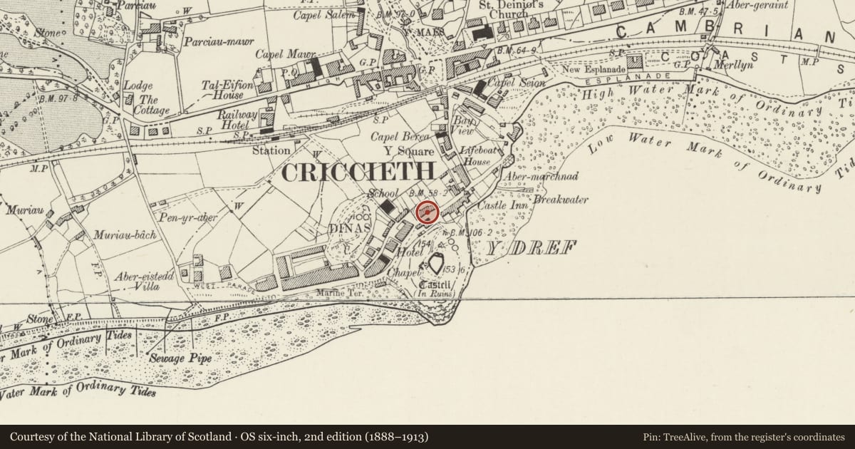
Slide toward Today to fade the historical sheet and see the modern map underneath.
David Rumsey Map Collection, Stanford LibrariesDavid Rumsey Map Collection, Stanford LibrariesDavid Rumsey Map Collection, Stanford LibrariesLlyfrgell Genedlaethol Cymru – The National Library of WalesDavid Rumsey Map Collection, Stanford Libraries
5 historical maps cover this location, the earliest the 1795 map "To Sir Watkin Williams-Wynn Bart ... the map of the six counties of North Wales is most humbly inscribed by his obedient humble servant" (Llyfrgell Genedlaethol Cymru – The National Library of Wales).
Historical maps covering this location
- 1795 · To Sir Watkin Williams-Wynn Bart ... the map of the six counties of North Wales is most… (Llyfrgell Genedlaethol Cymru – The National Library of Wales)
- 1883 · Watershed map England, Wales 3. (David Rumsey Map Collection, Stanford Libraries)
- 1896 · Sheet 7. Ordnance Survey of England and Wales. (David Rumsey Map Collection, Stanford Libraries)
- 1899 · 118 Nevin (Hills) (David Rumsey Map Collection, Stanford Libraries)
- 1901 · Sheet 9 and 10. (David Rumsey Map Collection, Stanford Libraries)
Cadw's description
Location
Facing the open ground at the entrance to the Castle, and forming a terrace with Nos 21-23.
History
The two houses were probably built or remodelled as a pair in the early C19, possibly incorporating earlier buildings, as they appear to be at least in part a continuous build with Nos 21-23.
Exterior
Roughly coursed and shaped boulder rubble, modern slate roof with red tiled cresting and end wall stacks. 2 storeys, each house has a 3-window range forming a 2-unit plan with doorway towards centre. Doors themselves renewed in earlier openings. No 27 has a 4-pane sash window to either side of entrance, and 3 similar windows above, which do not align with the lower openings. No 25 has a
2-pane sash window to left of doorway, and a long 3-light window to the right, relating to its previous use as a shop. 3 narrow 4-pane sashes above, aligned with the 3 lower openings.
Reason for designation
A pair of modest vernacular town houses which forms part of a group of older buildings close to Criccieth Castle.
Nearby in the register
- 25 Castle Street / Ffordd CastellDomesticunder 1 mi
- CemlynDomesticunder 1 mi
- TrefanDomesticunder 1 mi
- Criccieth Castle, Outer Bank DefencesCastleunder 1 mi
Other entries of the same register within about three miles of this one, by straight line.