Cof Cymru: National Historic Assets of Wales · Wales
Wern Farmhouse
Gladestry, Powys, Wales
A Grade II listed building in Gladestry, Powys, designated on 31 January 1995.
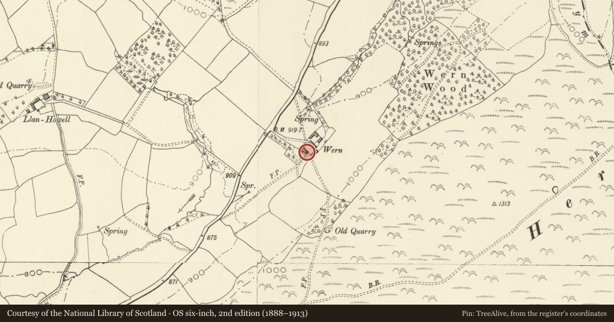
The record
- Designation
- Listed building, Grade II
- Broad class
- Domestic
- Date of designation
- 31 January 1995
- Locality
- Gladestry
- Community
- Gladestry
- Unitary authority
- Powys
- Country
- Wales
- Coordinates
- 52.19606, -3.11179
- Cadw reference
- 15344
Slide toward Today to fade the historical sheet and see the modern map underneath.
David Rumsey Map Collection, Stanford LibrariesDavid Rumsey Map Collection, Stanford LibrariesDavid Rumsey Map Collection, Stanford LibrariesDavid Rumsey Map Collection, Stanford LibrariesDavid Rumsey Map Collection, Stanford Libraries
5 historical maps cover this location, the earliest the 1608 map "(13) Cambriae Typus." (David Rumsey Map Collection, Stanford Libraries).
Historical maps covering this location
- 1608 · (13) Cambriae Typus. (David Rumsey Map Collection, Stanford Libraries)
- 1637 · Particular description of Wales. Cambria seu Wallia (David Rumsey Map Collection, Stanford Libraries)
- 1883 · Watershed map England, Wales 3. (David Rumsey Map Collection, Stanford Libraries)
- 1898 · 197 Hay (Hills) (David Rumsey Map Collection, Stanford Libraries)
- 1901 · Sheet 14. (David Rumsey Map Collection, Stanford Libraries)
Cadw's description
Location
Lies 1.6km NE of Gladestry on SE side of Kington to Gladestry road.
History
Early C19.
Exterior
Two storeys, rubble stone, slate roof, boxed eaves, brick end stacks. Central boarded front door, regular window arrangement under flat voussoir arches with keyblocks. Cross pattern windows to ground floor, casements to upper floor. One-and-a-half storey rubble and slate roofed range adjoins right-hand end, housing dairy, cellar and loft. Boarded door, shuttered square framed window to cellar, three-light casement to dairy. To the rear of this range is mid C19 twim gabled brick bakehouse/washhouse.
Interior
Original plan, simple period detailing. Four-panel door to parlour, stone flagged floors, beaded boxed beams, dairy has salting slab and original shelving and shutters. Bakehouse has oven, twim coppers and corner fireplace with chimney crane.
Reason for designation
A well-preserved example of an early C19 farmhouse of regional character.
Nearby in the register
- Former Meeting House to left of Gladestry Post OfficesDomesticunder 1 mi
- Gladestry CourtDomesticunder 1 mi
- Corner HouseDomesticunder 1 mi
- GwerndyfnantDomesticunder 1 mi
Other entries of the same register within about three miles of this one, by straight line.