Cof Cymru: National Historic Assets of Wales · Wales
Glan Terrig Farmhouse
Nercwys, Flintshire, Wales
A Grade II listed building in Pentre, Nercwys, Flintshire, designated on 12 December 1994.
The record
- Designation
- Listed building, Grade II
- Broad class
- Domestic
- Date of designation
- 12 December 1994
- Locality
- Pentre
- Community
- Nercwys
- Unitary authority
- Flintshire
- Country
- Wales
- Coordinates
- 53.12478, -3.13746
- Cadw reference
- 15244
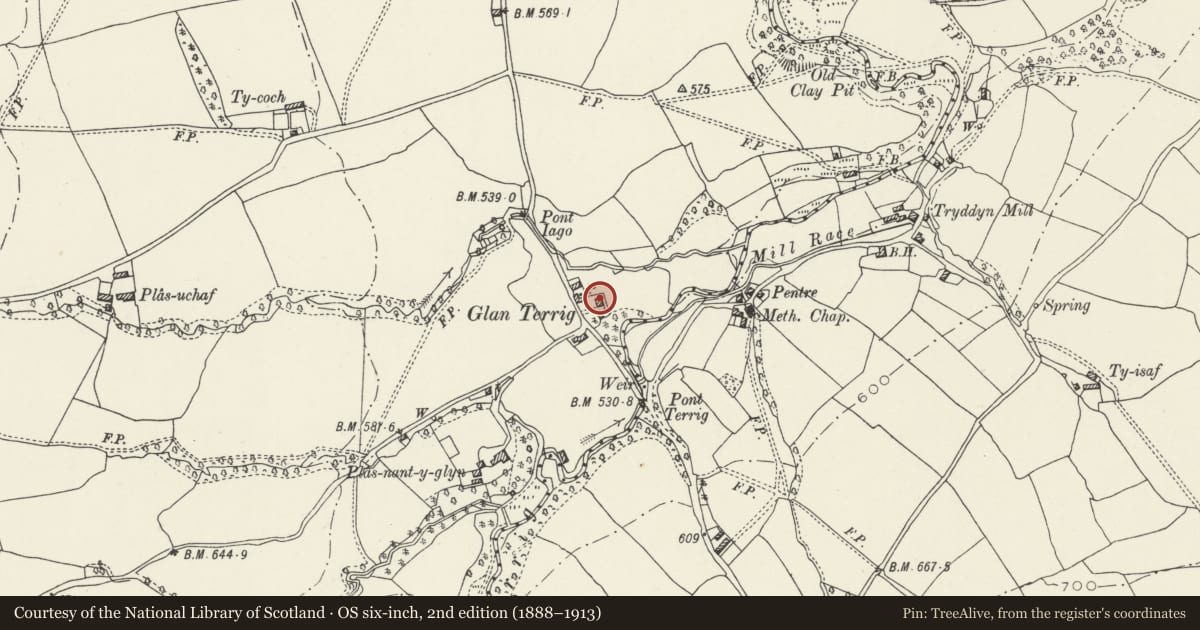
Slide toward Today to fade the historical sheet and see the modern map underneath.
David Rumsey Map Collection, Stanford LibrariesDavid Rumsey Map Collection, Stanford LibrariesDavid Rumsey Map Collection, Stanford LibrariesDavid Rumsey Map Collection, Stanford LibrariesLlyfrgell Genedlaethol Cymru – The National Library of Wales
5 historical maps cover this location, the earliest the 1795 map "To Sir Watkin Williams-Wynn Bart ... the map of the six counties of North Wales is most humbly inscribed by his obedient humble servant" (Llyfrgell Genedlaethol Cymru – The National Library of Wales).
Historical maps covering this location
- 1795 · To Sir Watkin Williams-Wynn Bart ... the map of the six counties of North Wales is most… (Llyfrgell Genedlaethol Cymru – The National Library of Wales)
- 1883 · Watershed map England, Wales 3. (David Rumsey Map Collection, Stanford Libraries)
- 1898 · 108 Flint (Hills) (David Rumsey Map Collection, Stanford Libraries)
- 1898 · 108 Flint (Outline) (David Rumsey Map Collection, Stanford Libraries)
- 1901 · Sheet 9 and 10. (David Rumsey Map Collection, Stanford Libraries)
Cadw's description
Location
To the SE of Nercwys village. Situated off Ffordd Nercwys to the E facing its own farmyard.
History
An early C19 late Georgian farmhouse incorporating an early C17 core.
Exterior
Rubble-built under a shallow-pitched slate roof with stone- coped gables and shaped kneelers. Plain brick end chimneys. 3-bay symmetrical facade. Central round-arched entrance with panelled doorcase and deeply recessed 6-panel door with contemporary door knocker. Simple glazed fan above. Stone
voussoirs to arch replace brick ones in a recent restoration programme. Flanking 12-pane flush sash windows, being modern replacements. Projecting stone cills and modern stone lintels as before. The E face has a large contemporary 24-pane window as before to the ground floor, with a 16-pane one above. Further 9-and 4-pane windows to R. 2 gabled projections to rear both coped and kneelered as before, that to the R (E), advanced with projecting end stack and both with brick chimneys. Modern single-storey addition reflecting the style of the original work.
Interior
The 2 front-facing ground-floor rooms with heavily beamed ceilings, deeply chamfered and stopped. Early C19 plain stair with pine stick balusters and mahogany swept rail. Plain early C19 fireplaces.
Reason for designation
Included as a late Georgian farmhouse with earlier origins and charming, well preserved character.
Nearby in the register
- Pont TerrigTransportunder 1 mi
- Plas Nant y Glyn (excluding C20 W Range)Domesticunder 1 mi
- Stryt SwndwrDomesticunder 1 mi
- Barn at Plas Ucha FarmAgriculture and Subsistenceunder 1 mi
Other entries of the same register within about three miles of this one, by straight line.